|
| Miller's River |
I'm back!! After almost a year of Real Life and ongoing issues with my left foot, I was finally back on the trail following the little painted rectangles that lead from Long Island Sound to Mt. Monadnock. My goal is Mt. Monadnock's summit before the end of the year, and I had four days to make some progress. It was a long, busy year, but it was finally time to hit the trail. Yes!!
 |
| Virginia Creeper berries |
Section 16 is seven miles long, including about 2.5 miles of road walking, mostly at the end of the section on Gulf Road. I had hoped to be backpacking this part of the trail, but doubted my left foot would make it. So my husband dropped me off at the old bridge across Miller's River for a day hike.
This is definitely the best time of year to be outside, so we took a long weekend and reserved a room at the nearby French King Hotel, where we stayed last year. It's located on MA 2 where the highway crosses the Connecticut River. We were gifted with four days of temps in the 70s and low humidity and no bugs. And school was back in session, so the trails were oh so quiet.
 |
| No blazes at Rt 2. The trail goes across and up Holmes Street |
From the Farley Bridge, the northbound trail came quickly to MA 2, and there were no blazes. I thought I saw one on a telephone pole down the street to the left, but I'll not be tricked by those white rectangular reflectors again. This road crossing was the only spot during four days of hiking where I really could not find a blaze. I stopped to look at the Massachusetts NET trail map, but that didn't help much other than to show the trail apparently followed the highway a short ways to the right before turning up a sidestreet. How far? Which sidestreet? I pulled out the AMC trail map for the area and still had no idea. The scale was too broad. Finally, I checked some photos I had stored on my phone from the M-M guidebook. Bingo. This map prominently labeled the road "Holmes Street" in green and I was in business.
 |
| M-M Guidebook Map to the rescue |
Where the trail has not been rerouted, the M-M Guidebook maps are definitely superior in Massachusetts. They have contours, are at a closer scale, and critical landmarks are called out in bold green ink. In the map above, landmarks like Holmes Street, the Bridge, Erving Castle Site, and the vista all jump out at you. Sadly, much of the trail was rerouted, making many of the maps obsolete. For the most part, I used an
AMC trail map for this area. The NET reroutes all seemed to be shown on this map, and there are contours so you know where to expect the hills.
 |
| Shared access point for rock climbers at Rattlesnake Mtn |
Very soon after crossing MA 2 and walking up Holmes Road was a small parking lot for about eight cars. The lot was full already on a Saturday morning at about 11 a.m., so it's a good thing I was dropped off down by the bridge. I suspect most of the cars belonged to rock climbers because I saw only a couple hikers
 |
| A very welcoming trailhead |
There's a beautiful trail entrance near the parking area, one of the most welcoming trail entrances I've ever seen, and a great way to slip back into NET hiking mode. Side trails soon diverge from the M-M Trail as the white blazes follow the rocky channel of Briggs Brook up the hill. I passed two sets of hikers along this section, and no one else the remainder of the day.
 |
| Briggs Brook |
There are are a number of handmade trail signs along the route from here all the way to the New Hampshire border. I like the signs. They have a lot of personality and charm.
 |
| Some of the local folk art |
After following the brook up the hill for a bit, the trail takes a right turn and heads towards Hermit Mountain. There's a side trail leading to where "The Hermit" once lived, but I did not take it.
 |
| More artwork |
I passed a small boulder with six parallel lines on it. Mystery lines. I've seen a lot of marks on rocks, but not like these. Your guess is as good as mine. Any ideas?
 |
| The mystery lines |
Off to the left on top of the hill is the noteworthy Northfield Reservoir. This is not your average reservoir. Below it, inside the mountain, lies a hydroelectric plant that consumes more energy than it creates. Yeah. Water from the Connecticut River is pumped up to the reservoir when electric rates are reduced (like at night), and then dropped through a set of turbines when the rates are high. It supplies energy during peak need, so it makes money.
 |
| Northfield Reservoir |
You can't actual see the reservoir from the trail, just the very long dam holding the waters back.
 |
| White Snakeroot thrives in the reservoir seepage |
Water seeps out from the reservoir in one or two places, and thru hikers are advised to assume the water in the area is contaminated since it was pumped out of the Connecticut River. White Snakeroot was in bloom at one of the seepage areas. The plant is highly toxic and once caused "Milk Sickness" when people drank milk from cows that had eaten the plant. Abraham Lincoln's mother was said to have been killed in this way.
 |
| Chicken of the Woods |
From the highly toxic, to the delicious: Sulfur Shelf, or Chicken of the Woods, is a delicacy that tastes like (what else) chicken sauteed in mushrooms. I only saw a small patch. Sometimes there are huge patches that can be harvested.
The trail goes along the ridge and the top of a sharp drop off, and I was teased with seasonal views, blocked by it being the wrong season. This went on for a bit and I feared there would be no real views. Until this...
 |
| Wow. |
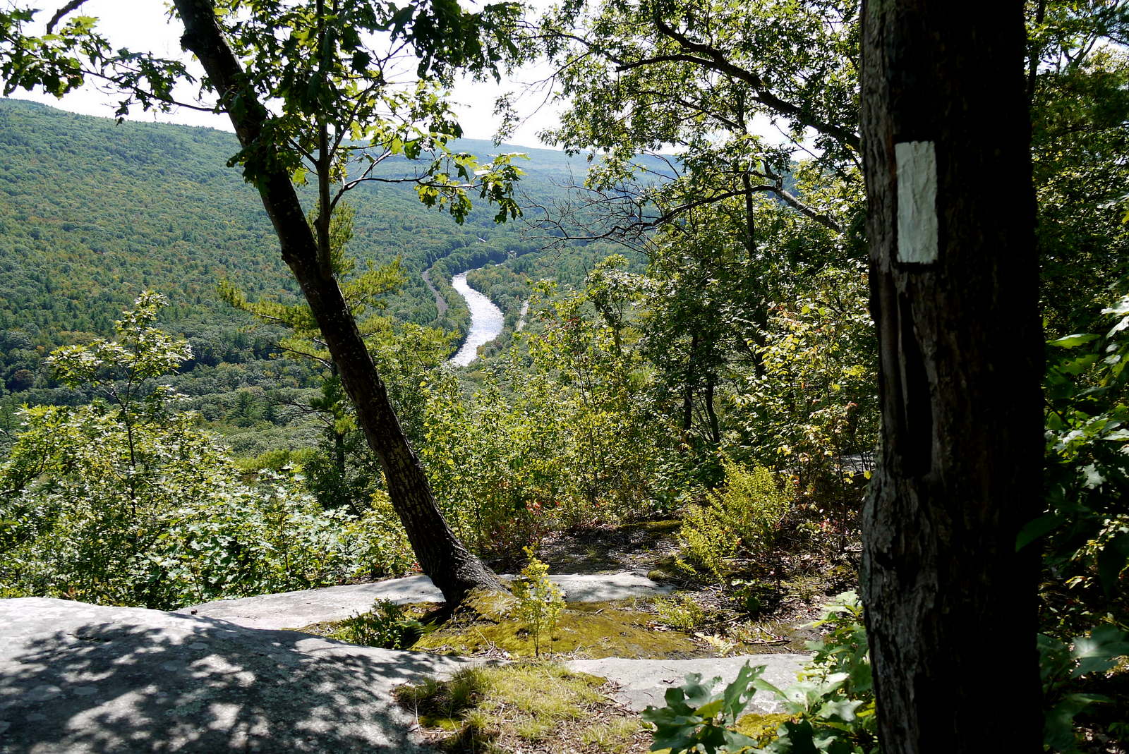
...a cave of sorts with amazing views of Millers River Valley. Time to stop for lunch!
 |
| Miller's River. Note the black dead liverworts on the boulder. |
So peaceful. A Bald Eagle soared over the river far below. Ahhhh. Time to rest the left foot. It was already hurting.
The boulders there were covered with black, dead liverworts, victims of the severe drought last year I assume. Liverworts will brown up and curl when stressed, but these were completely dead.
 |
| Fern-Leaved False Foxglove |
I love running into plants that are new to me. From this rocky overlook to the next was a showy yellow flower in bloom I later identified as Fern-Leaved False Foxglove.
 |
| Second overlook |
The well-maintained trail then left the ridge and meandered pleasantly and quietly through Erving State Forest. My left foot told me to stop. I told it to shut up.
 |
| Hobblebush |
Eventually the white blazes crossed Mountain Road alongside farmland, and the character of the trail changed a bit.
 |
| Trail goes behind this farm at Mountain Road |
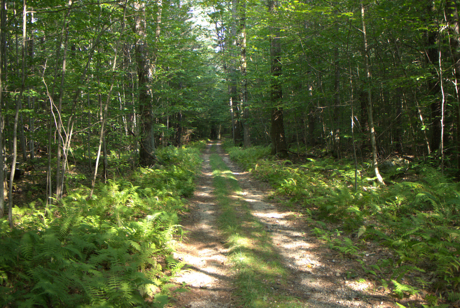
After following an old woods road a short ways, the trail turned behind the farm and became a bit overgrown in places, although it was never too hard to follow. One just had the feeling that not many people hiked this section.
 |
| Old woods road |
I started seeing good sized droppings full of dark berries, maybe viburnum. Bear? Coyote? Not sure. As I got closer to South Mountain Road, there was a set of droppings filled with apple chunks. Bear? Deer? Really, it seems like wild animals would do a better job of digesting their food.
 |
| I'll call this one "Toasted Marshmallow" |
There were plenty of black and white fuzzy caterpillars creeping across the trail throughout the four days of hiking. At home I was able to identify them as Hickory Tussock Moth caterpillars. Several years ago people started sharing warnings about "new" caterpillars that are "poisonous" on social media, and there is a Snopes entry about the claim ("Partly True"). The long black hairs can inject an irritating substance into your skin that some people react strongly to.
 |
| Hickory Tussock Moth Caterpillars. Don't touch! |
And then I came out onto South Mountain Road and the beginning of a 2.3 mile road walk on a bad foot. Sigh. This is another one of those sections that used to be amazing but was closed down by the landowner after the Federal Government officially noticed that the trail existed and said it was nice. There were views of Monadnock on the old section, now reserved for the birds.
 |
| Road Walk for 2.3 miles (sigh) |
The landowner had plastered "POSTED" signs to guard the woods on both sides of South Mountain Road. At one point there had been some utility work, and POSTED signs were stapled all over the cut logs.
 |
| "Mine! Mine! Mine!" |
It brought to mind stories from my husband's family of rural Vermont. It was said that generations of Vermonters had by tradition allowed people to cross their land for hunting, fishing, or walking. Then rich New Yorkers started buying up properties and the first thing they did was put up 'no trespassing' signs that looked obnoxious and blocked people from getting where they wanted to go. Maybe that's when they started saying, "Can't get theah from heah."
 |
| Rogue camera shot on South Mountain Road |
Ah, the left foot. The screaming left foot. I took it real slow, but every step hurt. I was limping now and stopping from time to time. The podiatrist had tried a few cortizone injections, suggested a possible nerve issue, and more or less gave up. I dread what my foot would feel like the next day.
 |
| New England Aster and Goldenrod |
It's not a bad road walk, though. South Mountain Road is mostly woods and no cars. Gulf Road is a lot busier, but there is working farmland and logging operations on either side alongside a few homes.
 |
| Gulf Road |
About half way up Gulf Road, my ride pulled up behind me. I wanted to finish the section, so I tossed my pack in the car, grabbed a cold drink from the cooler, and continued walking. My patient husband drove on up to the trailhead to wait. Shortly after, I passed a sign that said, "Free Stuff" and I gave it a look.
 |
| Huh. Let's check it out. |
Not much there, but I did nab a Christmas coffee cup as a souvenir, and continued on to the end of the section.
 |
| There's my souvenir coffee cup for 2017 |
And although I was a disappointed to not be backpacking, I cannot lie: That hot shower was amazing. Also the cushy bed. And dinner at a restaurant.