Showing posts with label Metacomet-Monadnock Trail. Show all posts

Tuesday, October 17, 2017

NH M-M Section 22: Mt. Monadnock, the Grand Finale


Mt. Monadnock in morning sunlight with bright fall leaves
Mt. Monadnock from our Airbnb apartment
(Click photos to enlarge)
Last day on the New England/M-M Trail! As we strolled out of our Airbnb apartment with a breathtaking view of Mt. Monadnock and vivid October leaves, our host Jo came past and said she had left fresh banana bread right outside our door in the hallway. I went back in and grabbed the steaming hot bread and we devoured a piece of this unexpected treat even though we'd already had breakfast. Pretty sure we were going to burn off those calories.

Mt. Monadnock at sunset with ominous dark clouds
Monadnock from our Airbnb apartment the night before
This was our first time trying Airbnb and it worked out pretty well. Previously we had stayed at local hotels and had good experiences, but we wanted to try something different. For slightly more than we paid for a room before, we got a full apartment with a living room, kitchen, bedroom and bathroom and a view of Monadnock. Nice!
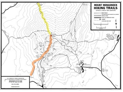
Map of Mt. Monadnock highlighting the M-M Trail and Monadnock Sunapee Greenway
M-M Trail in orange (Royce/White Arrow Trails)
Monadnock Sunapee Greenway (Dublin Trail) in Yellow
The way up Monadnock was predetermined: The M-M trail follows Royce Trail up to the popular White Arrow Trail near the Halfway House, then follows the White Arrow Trail up to the top. But what was the best way down? I settled the question by asking Google, and was advised that Dublin Trail was a good choice. And, as fate would have it, Dublin Trail is also the beginning of the Monadnock-Sunapee Greenway trail that goes another 50 miles to the north to Mt. Sunapee. Sweet! If I went down that way, I'd have the first couple miles of that trail done in case I wanted to hike that trail some day.

Trees along the M-M Trail at the base of Mt. Monadnock
A gentle start on a crisp fall morning
My husband dropped me off in the 'no parking' zone where the M-M crosses Rt 124 and drove off towards the Dublin Trailhead. He had surprised me by wanting to hike up Monadnock, too. Usually he golfs while I'm out hiking. "Go slow!" I told him. "Make it last. That's what I'm going to do." I didn't want to feel rushed.
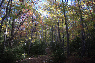

Trees with changing leaves along the M-M Trail
Fall color at the base of Monadnock
The trail started out easy and was worn just enough so you knew where it went without having to deal with erosion or crowds. The lack of parking on Rt 124 keeps most people off of this trail, and some of the maps don't even show it. The best place to park for the Royce Trail is probably the north parking lot for Gap Mountain, which adds an easy 0.8 miles to the route each way.


Quote from Henry David Thoreau seen at the Monadnock Visitor Center
Quote from Henry David Thoreau at the Visitor Center
From Rt 124 to the top, the M-M gets progressively steeper and the footing more difficult, so that by the end you are essentially rock climbing. The beginning was an easy morning stroll, but I still made a point to slow myself down. A quote by Thoreau stuck in my mind: "They who simply climb to the peak of Monadnock have seen but little of the mountain. I came not to look off from it, but to look at it."  
Golden hobblebush leaves along the M-M Trail
Hobblebush
And at one point is suddenly struck me that as eager as I was to complete the NET/MM, I suddenly didn't want the trip to be over. I wanted to savor the last few hours and make them last. Everything was perfect. The day was crisp, cool, and clear, but not too windy. The leaves were at their peak.  The cast on my broken hand had been replaced with a much smaller splint that allowed me to bend my wrist and was far more comfortable.

There had been a hard frost over night and it was probably 40 degrees when started, so I had a lot of layers on. As I walked up the steeping hill, one layer after another came off. Finally I stopped and switched from jeans to a pair of shorts I didn't expect to use but packed anyway.

Old sign that says "Royce Tr. Metacomet-Monadnock Tr."
End of the less-traveled Royce Trail. 
The character of the hike changed dramatically when the Royce Trail ended at a major trail junction and the M-M began to follow the White Arrow Trail. Before continuing uphill, I took a turn on the White Arrow Trail headed downhill  to the site of the old Halfway House. It was much closer than it looks on the park map and well worth the detour. The sky opened up with views of the peak and the surrounded countryside below.

View of the top of Monadnock as seen from the Half-Way House site
Halfway House Site looking up at the peak

Old photo of the Half-Way House
What it used to look like.
At this point people were trickling up the popular White Arrow Trail. It wasn't crowded (this was a Tuesday in October), but I could just image the crowds on a weekend in the summer. Before hiking the New Hampshire M-M I had no idea that more people hike the Grand Monadnock than any other mountain in the world except Mt. Fuji in Japan and some mountain in China. For us, this part of New Hampshire was the drive-by section on our way to the White Mountains or Acadia.  Monadnock is popular in Boston, but in southwest Connecticut it seems most people have barely heard of it.

Vista from the Half-Way House on the White Arrow Trail
Vista from the Half-Way House site on the White Arrow Trail. 
Monadnock was a popular spot for tourists going all the way back to the early 1800s. The White Arrow Trail was cut in 1854-55, with the lower part expanded to a wagon road in 1857. A few years later, the Mountain House was built at the top of the wagon road, and Ralph Waldo Emerson stayed there. It burned down in 1866, but was replaced with a building that was gradually enlarged and renamed the Half-Way House in 1919. You wouldn't know that now unless you took some time to explore the edges of the clearing.  Which I did.

Black chokeberries at the Half-Way House site
Black Chokeberry at the Half-Way House site
The rock is heavily carved, and some of these carvings could be pretty old. The one below caught my eye. I can't figure out what the symbols mean.

Carvings on rock at the Half-Way House site.
The mountain is full of carvings
After that diversion, I headed back to the well-signed junction of the White Arrow and Royce Trails, and continued up the White Arrow Trail.
Trail sign that says "White Arrow Tr." nailed to a white birch with vivid fall leaves
It's all rock underfoot now.
From here on up the trail was completely different than the Royce Trail had been. That gentle trail had dirt under foot and wasn't eroded much. This trail was all rock. It started out with some attractive steps but before long it was all boulders. Boulders, boulders, boulders.  The deeply eroded trail looked like a dry mountain river bed.

Rock steps on the M-M Trail
First some steps...

The trail becomes a series of boulders to step on
...and then I think they just gave up on steps. Walk up the boulders. 
The boulders aren't so much difficult to walk on as tedious. I forced myself to go slow. No point in breaking an ankle. The boulders go on and on and on.

Flat stepping stones over a wet spot
Easiest part of the White Arrow Trail
But finally the boulders came to an end and it was smooth, sloping bedrock all the way to the top. That's when it really started to feel special and different. And the views began to open up. The hard schist underfoot was full of white sillimanite crystals a few inches long. The mineral was discovered here at Monadnock and named after Benjamin Silliman, a geologist from Yale.

Large flat rock with white sillimanite crystals
Sillimanite crystals taking the shape of Andalusite
The sillimanite crystals are actually in the shape of andalusite crystals. Sillimanite and andalusite  have the exact same chemical composition, but different crystal structures,  like graphite and diamond. When the metamorphic schist was forming at Monadnock, low metamorphic temperature and pressure resulted first in andalusite crystals. But then the temperature and pressure increased, and the andalusite crystals converted to sillimanite, while keeping the shape of the andalusite crystals. In geospeak you say, "sillimanite after andalusite."

Small rock plant surrounded by rock
Three-toothed Cinquefoil
When we were at the visitor center the day before, I took pictures of the wall displays pertaining to plant communities at Monadnock, which is how I was able to identify the tiny three-leaved rock plant which I had also seen at the top of Gap Mountain. My number one rule for identification of plants and animals is to find the most local key possible, and you can't get more local than the one at the visitor center.  There was a display for each plant community, including the, "red spruce-heath-cinquefoil rock slope" said to occur at elevations of 2500 to 3000 ft. The top of the mountain is at 3166 ft, so this seems about right.

View of the M-M Trail on open rock with a few trees and blue sky
Rocky ledge. It's getting dramatic.

Looking between rock faces and the countryside far below
Steep. Getting pretty steep. 
Monadnock used to have trees at the top until white settlers supposedly burned the mountain down a few times to get rid of wolves, which were eating their sheep. The thin soil washed away and left only rock. It's not a tree line based on climate like the one at Mt. Washington. Back when it hid wolves, people didn't much care for the mountain. Once the wolves were gone, people suddenly grew fond of the big rock and began climbing it.


M-M Trail on rock face with bright red mountain ash berries
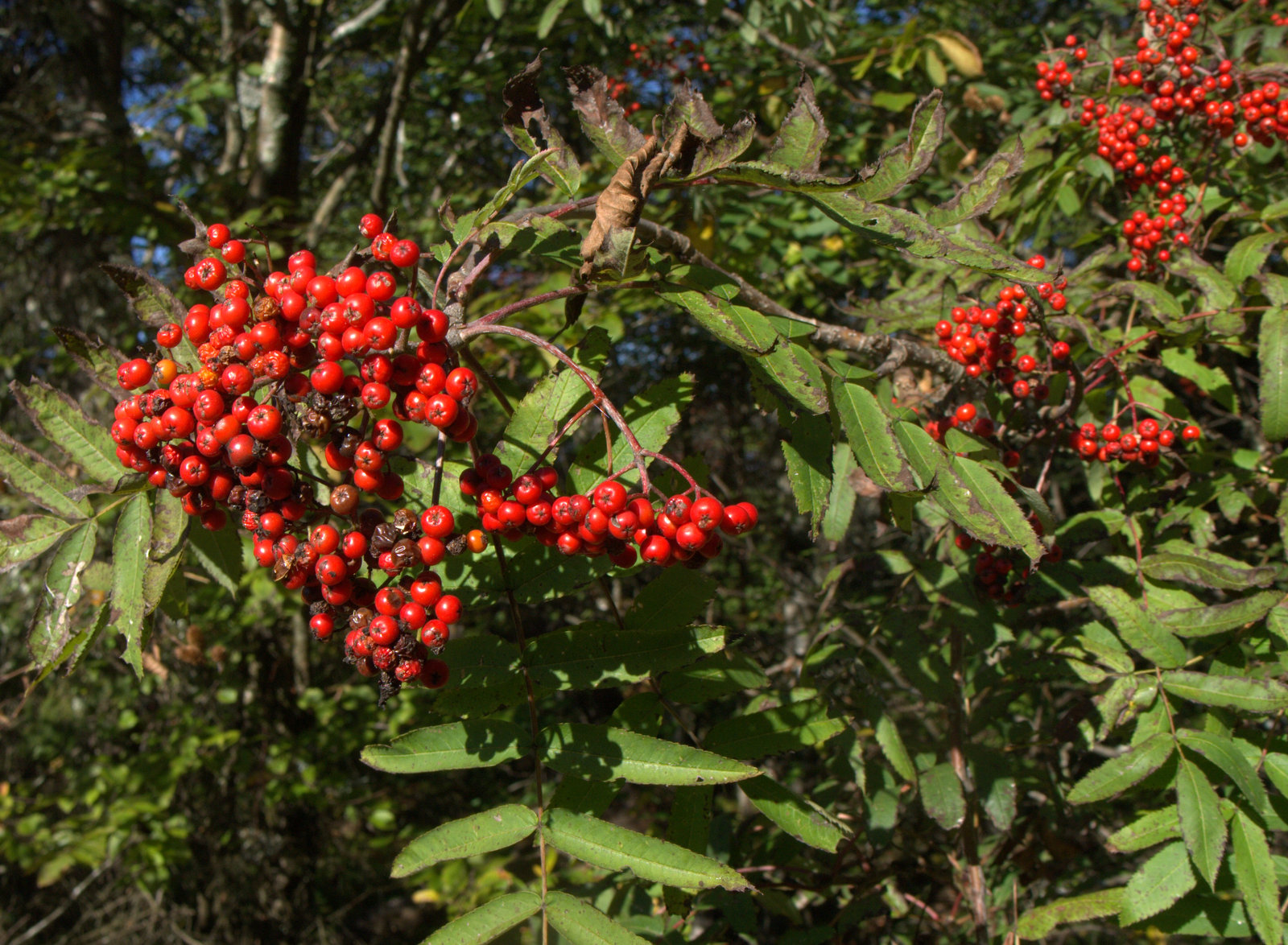
Mountain ash berries brightened up the rocky slopes.
As the trail climbed, vivid mountain ash berries started to decorate the rock. They were all over.

View of countryside far below including Gap Mountain and Little Monadnock
Wow. 
Up and up and up.  Everything was a post card now. The trail map showed an Ampitheatre Trail crossing at right angles to the White Arrow Trail, but I was looking for it and never saw any markings.

Looking up towards the top of Monadnock, where people can be seen
Can see people at the top now. Heading for that notch in the center.
Climbing over a rise, the peak came into view and I could see people on top. And I could hear them, too...screaming teenagers. They were so loud and obnoxious.  I sat down and  took a break before that last push up. At this point I'd only had a few sips of my 2.5 liters of water since it was so cool out and I was going so slow, so I dumped most of it.  The last part was almost vertical and the weight of my pack would be pulling me backwards, so it was best to lighten the load. I also folded up the trekking pole and stuck that on the pack as well. I would need both hands for climbing. Finally, the good camera got packed because I was tired of it dangling in my face. As a result, I have no pictures of the last part of the climb, but here's a great one from the visitor's center:


Old photo showing a group of men and women climbing up the last section of the M-M Trail
1905 photo near the top of that notch
That last part was slow and I had to wait for some people coming down. They told me there was a class of middle school kids up there doing all the screaming and offered that it helped to keep some rocks between you and them.  I noticed how the people coming down were bundled up in winter coats, while I was perfectly comfortable in shorts and tee shirt. Although it was a pretty long, steep scramble, there was always a reasonable place to put your feet and hands and I never felt scared.

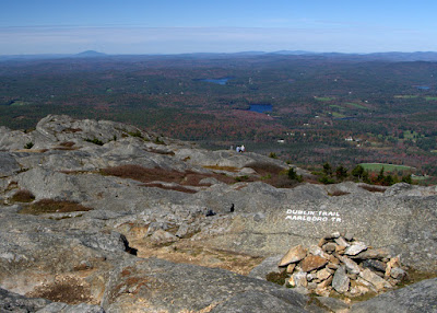
Then I got up over that crest, and that was it. I was done.  I had thought there might be more. Nothing announced the end of the M-M. There were just some markings for the Dublin/Marlboro Trail nearby, which is where the M-M ends. It took a moment to sink in. I looked around not 100% sure that was really it. It was.
The rocky crest of the White Arrow Trail
Cresting the notch and looking back

Panorama of the top of Mt. Monadnock
Top of the world!

Cairn marking the end of the M-M Trail and beginning of the Dublin Trail
End of the M-M Trail and the beginning of the Monadnock-Sunapee Trail!
Mt. Sunapee is in the distance. 
The screaming teens had thankfully left and the dozen or so people up there were just quietly soaking in the view. Gorgeous.


Gap Mountain and Little Monadnock as seen from the top of Mt. Monadnock
Gap Mtn and Little Monadnock look kind of flat from up here
And cold. The high at the base was supposed to be in the 50's and it was around noon, so maybe it was in the 40's there, but with a good wind.  My shorts and a tee shirt were quickly augmented by several additional layers. They say to expect the temperature to be 10 or 15° cooler at the top, plus a wind chill. That sounds about right.

Jagged rocks and low plants at the top of Monadnock
Exploring the top
My husband was still heading up the Dublin Trail with sandwiches, having stopped at the visitor center on his way over and starting his hike almost an hour after I did. So I walked around the top taking pictures for an hour or so. I never got bored.


Tiny pool surrounded by dried vegetation at top of Mt. Monadnock
One of several tiny puddles hosting Tussock Cottongrass

Thoreau was right when he said, "The great charm is not to look off from a height but to walk over this novel and wonderful rocky surface."  The top of Monadnock is so high relative to the land below that everything in the distance seemed flattened and faded, like looking out the window of an airplane. Even the fall colors were muted. The effect is an amazing backdrop to that rocky surface, though.


Mt. Sunapee as seen from top of Mt. Monadnock
Mt. Sunapee off in the distance
Eventually my husband joined me and we sat facing Mt. Sunapee off to the north while we ate our sandwiches. I started getting cold. I had more layers in my pack but didn't feel like putting them on, so I started down the Dublin Trail very slowly to get out of the wind while my husband proceeded to the very top to check out the panoramic view.


Trail sign for Jim's Junction: Dublin Trail and Marlboro Trail
Dublin Trail is also the beginning of the Monadnock-Sunapee Greenway
So. The M-M Trail was done and I was starting a new trail and a new adventure! I wasn't sure if I was ever going to hike the rest of the Monadnock-Sunapee Greenway, but I could. Why not? Dublin Trail is also called the Old Farmer's Path and was the first of many trails built to the summit.
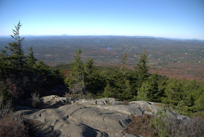
Open, rocky exposure on the Dublin Trail
Typical sloping rock for much of the Dublin Trail. 
The Dublin Trail was not as steep as the White Arrow Trail, thank goodness. But it was wetter, and there were places where we had to either walk through water or carefully step on the dry spots to keep our soles dry. Wet boots can slip on that rock pretty easily, so we were cautious going down. It seemed to take forever, but there were spectacular views for much of it.  There would be a flat stretch for 50 feet, and then another moderately steep section of rock to pick our way down. Over and over almost all the way to the bottom. 

Short flat stretches between rocky slides

There were a number of spots where we would get on our butts and slide and at one point a big hole ripped open in the back pocket of my cheap Cabela's hiking shorts where I had stuck my camera lens cap.
Very rocky Dublin Trail
Much of the Dublin Trail was like this. 
But eventually the rocky outcrops finally ended and we were able to stroll down to the parking lot on Old Troy Road. It was getting late and the sun was low. I joked that Mt. Monadnock was the old person's Mountain Washington, which got a laugh. We had done Mt. Washington 25 years ago when we were both a lot younger and thinner and didn't have various maladies of the knees and ankles and feet. Although the climb up Washington is about twice as high as Mt. Monadnock, I think the effort and time we spent climbing Washington in our prime was about the same as our older selves climbing Monadnock.  But hey, we did it.

Low sun shining through the trees
It's getting late. A full day of hiking!
We got to the parking lot at 5:15 pm. Almost 8 hours on the mountain. The parking lot was nearly empty and we had only passed a few people on the Dublin Trail.

Large empty parking lot on Old Troy Road
A very empty parking lot
So now what? Is the story over. No! The Monadnock-Sunapee Greenway has just begun. Two miles down and 46 more to go!

Monday, October 2, 2017

NH M-M Sections 20b-21 Little Monadnock & Gap Mountain


Really nice job on the metal signs.
Day 2 of the New Hampshire M-M Trail started at Widow Gage Town Forest in Fitzwilliam and I meant to stop after the Troy road walk, leaving Gap Mountain for Day 3. But by the end of the day I had done both hikes and was at the foot of Mt. Monadnack.

"Curved stone wall"
Clearly a lot of love has gone into Widow Gage Forest by the Fitzwilliam Conservation Commission. They have an excellent trail map to go along with the well-marked trails. Landmarks labeled on the map include "curved stone wall" and "massive rock pile" so you have something there to look forward to. They've installed nice custom metal signs, too. Nicely done.

You got It! (Also, I feel loved.)
Before long, the access trail meets back up with the M-M Trail and the slow climb up Little Monadnack begins. This way up wasn't steep at all. This was a coffee-sipping stroll. I looked forward to getting to the top and finally getting some views.

Morning stroll up the mountain
And the view of  Mt. Monadnock from the summit was well worth it. The last view of the mountain was at the Richardson-Zlogar cabin, and the trail is definitely a lot closer to the finish line than it was then. How exciting!

Little Monadnock summit. 

Rhododendron S.P.
There's a trail junction at the summit with a steep trail that leads down to Rhododendron State Park. That's another option for accessing the M-M Trail. The next day we stopped at the state park  on our way home to see the rhododendrons and it was well worth it. There's an expansive 16-acre grove of Rosebay Rhododendron, perfectly wild and natural and not something you normally see out hiking in New England.  This species is huge for a rhododendron, growing up to 30 feet tall. We have one planted on the north side of our house where it gets almost no sun. Even so, it's about eight feet from the ground to our lowest window, yet we still have to cut the rosebay back hard every few years.  At the state park, you walk through areas that are essentially rhododendron tunnels. 

It must be amazing when it's in bloom. The only other time I've seen wild Rosebay Rhododendron in New England was in Patchaug State Forest in Connecticut, where it was growing in a swamp and a boardwalk takes you through the grove. Although the grove in New Hampshire wasn't exactly swampy, it was low and probably gets a lot of water seeping out of Little Monadnock.

Well-weathered summit marker
Up at the top, there were striking clumps of mountain ash berries only a few feet from the summit marker. Mountain ash makes me think of the White Mountains further north. It's not something I see hiking in Connecticut. It's something I see on vacation.

Mountain Ash
Hiking with the cast on was working out OK. I was worried my hand would swell up or something and I'd have to bail out, but it was good. Better than being at work trying to type. As long as I didn't have any scrambles, the cast didn't interfere with hiking too much. I will note that wrists are highly underrated. You don't realize how well they rotate your hand into the correct position to do things like turn door knobs or put a cell phone in your pocket until you can't move your wrist.


Hiking with a cast. 
After the summit, there were a few more views, like the one below. Notice how the ledge drops off steeply and how far down the tops of the trees are off to the left. Where the trail was headed.

Another view, with the trail going straight down the ledge.
I walked down the ledge OK (good thing it wasn't wet), until the last fifteen feet or so, which was a seemingly impossible scramble. Sure, my 20-year-old cast-less self probably would have laughed at this, but it hasn't been the 1980's in a very long time.

It's steeper than it looks, I swear. That's my pack at the bottom.  
I sat at the top of this scramble for a good twenty minutes trying to figure out how to get down without breaking a leg. Never make a rash decision out in the middle of nowhere, right? I rolled my pack down, and was then fully committed. But I still couldn't figure it out. The rock was smooth and mossy and slick with pine needles and leaves. And I couldn't use my right hand to grip anything. This was the worst scramble of the entire NET, and I went down the Chauncey scramble before it was rerouted, so that's saying something. But the Chauncey scramble actually had nice squared places to put your toes and hang on with your hands once you studied it. This had nothing.  I didn't even have any rope. I had visions of breaking an ankle (which I've already done three times, twice going out for the school bus and another time up a mountain like this one) and the embarrassment of getting hauled down the mountain. And then I'd be wearing two casts!

Looking back. 
I finally chose a spot off to the side, cleared out some potential finger holds at the top of the rock, then got on my stomach and slide down that way about four feet to a small ledge just a couple inches wide. I was terrified my feet wouldn't stop at the ledge because everything was so rounded and mossy, but they did. I halted there for a minute or two, carefully clearing leaves and needles off of the ledge, then finally made a move down to another marginal ledge, then another and I was down.  Oh thank goodness.  Later that day I opened up the M-M Guidebook to see what it said about that insanity, and it simply told hikers to "slide down over a nearly vertical, small rock face." Slide down? Is that a thing? Apparently it is. If I had known that was the normal way to get down and my hand wasn't in a cast I'm not sure if I would have tried it or not. I almost want to go back and try to master that skill. Almost. At any rate, that's a good spot for a bypass trail if possible. Next time I hike in New Hampshire I'm bringing rope.

Sarsaparilla
Relieved to still be on two unbroken legs, I meandered on down the trail and came to the next challenge, which was finding the blazes across a very wide powerline clearing. It was kind of like a scavenger hunt. Are they down this way? Nope. How about this way? Nada. Oh, hey there's one. Ok where's the next one? The blazes were all on rocks and didn't go down the various roads and paths like I expected, but climbed up rocky features and then plunged back down into brush. It wasn't a big deal because it was still morning and I had all day and was in no rush. If dark was approaching it could have been a problem.

There are worse things than hunting for blazes in a beautiful area. 
Before long the trail came out onto a rough dirt road and followed the road all the way into Troy. The road gradually improved as it continued east and eventually evolved into Prospect Street.

Prospect Street, still a dirt 4WD road, passing a beaver pond
It was a pleasant morning walk down the hill. The scattered houses became more frequent as the road descended and approached Troy.

Upper Prospect Street

Concerned chickens.

Troy Railroad Depot, where hikers used to start their Monadnock climb.
Back in the day, people like Henry David Thoreau used to take the train to the Troy Railroad Depot, where they would get off to begin their climb up Mt. Monadnock. The train station is wonderfully preserved, although the doors were locked as I walked by.

Water Street
I turned east onto Water Street when I got to Troy. I didn't see any blazes on Water Street and it could be the trail technically goes up to the next street before turning east. The night before I had studied the maps and it seemed like there were a couple different versions of what street you were supposed to go down. This was the fastest, so that's what I did.

View from Water Street
There sadly didn't seem to be any shops open, but it was a Monday, and it seems that many of the restaurants and shops are closed on Mondays. I turned right onto Highway 12 and began following the white blazes down the sidewalk through a well-kept neighborhood. At one point there was a pickup truck parked up on the sidewalk and as I passed it a couple of older gentlemen leaning against the truck gave greetings and asked how far I was going. Everyone is so nice.

Highway 12
My plan was to complete the road walk at the end of Quarry Road and call it a day, leaving Gap Moutain for the next day before heading home to Connecticut. Shortly after turning onto Quarry Road, my husband drove up and I was able to ditch the pack for the rest of the road walk.  He drove up the road and explored a spring house located where the trail leaves Quarry Road. The spring house protects the water coming up out of the ground and there's a hole in the floor where people can fill containers with water. The water looked pretty stagnant, though.

Spring House at the end of Quarry Road
I caught up with my husband at the spring house and it was only 1:30 pm. I didn't want to stop. My arm was doing fine in the cast, and Monadnock was getting so close. My husband was up for a hike, so he left me there with a lightened pack and drove off to the north parking area for Gap Mountain. The plan was this: I'd climb up from the west and he'd climb up from the east and we would meet at the summit and go down together. That way, if there were any steep scrambles like that "slide" on Little Monadnock, I wouldn't have to do it alone in a cast.

Spring House
Gap Mountain was a much steeper climb than the ascent up Little Monodnock had been earlier in the day, and the afternoon sun was beating down on the west side of the slope. My photos turned out to be nothing but sun glare and deep shadows. The cast on my arm was getting itchy. I began to question my judgement at continuing on when I was in such couch-potato physical condition (in my defense, I was lame for the past year). But Monadnock! 

Wolf trees and stone walls from an old farm.
Gap Mountain appears to be a very popular place to hike, although not on Mondays in September because I only saw one other set of hikers the entire day. A huge amount of work has gone into improving the trail and addressing erosion, with a number of stairs and water bars in the steeper areas. 

Signs of former farmland abounded, especially rock walls lined with big old wolf trees from when the land was an open pasture. About half way up there were the skeletal remains an old apple orchard interspersed with pioneering gray birch. 

Old apple orchard converting back to forest.
After several stops to catch my breath as the path steepened towards to the top, it leveled off and opened up. Wow. What a joy to reach the first summit! Look at Mt. Monadnock, no longer off in the distance, but right there.
Middle Summit - Wow!
After snapping a few photos I continued on to the north summit, which was very close by and easy to get to. The view was even better. Holy cow. No wonder a lot of people climb Gap Mountain.
North Summit - Even better!
I was still taking pictures when my husband joined me at the top. Great timing! That worked out well. We lingered for twenty minutes or so just enjoying the view, the cool fall breeze, and the warm sun. Then we headed down the hill.

Winterberry at the summit
In contrast to the hot and sunny west slope, the east side of Gap Mountain was in late afternoon shadow and it was darker and cooler heading downhill. The trail was well-built and although rather steep, there were no major scrambles or spots with bad footing. A pleasant descent.


Some of the rock work at Gap Mountain


At some point the trail begins to be called the Royce Trail. I'm not sure if that starts at the top of Gap Mountain or what, but the local Royce Trail name for the M-M continues on up Mt. Monadnack a good ways before the M-M begins following the White Arrow Trail.
 Royce Trail = M-M Trail on Gap Mountain & Mt. Monadnock
I was surreptitiously checking the trail map as we headed down the mountain and ascertained that it was 0.8 miles from the north parking lot, where the car was parked, to Route 124 at the base of Mt. Monadnock.   So close!

Getting so close!
So you won't be surprised to hear that when we got to the parking lot turnoff I just kept going straight and said, "Pick me up on 124!"

Old pastureland
It was a nice last bit of walking along a well-used trail through the lush forest and before long I came out onto the highway. Whoohoo!  There's a pull-off where the M-M crosses the highway, but it's full of 'no parking' signs. So that's inconvenient. But sitting in a car for a few minutes seemed OK.

Route 124 and the foot of Mt. Monadnack P.S No Parking
There! All ready for Monadnock, which would have to wait until I got my cast off.

I was pretty tired that night. I don't usually get too focused on stats like mileage or elevation, but I added up the total for the day and it was 9.6 miles with more that 2,000 feet in elevation gain. That was a lot for this couch potato. So, so tired!