Thursday, October 31, 2013

Eagles Beak Point, Haddam

First balloon litter of the day
We continue our journey up the NET spur along hard knobby rocks much older than the traprock of the mainline. Each time I drive to the spur, coming from the west, I cross that distinctive pattern of low redbeds and high traprock cliffs that characterizes the Hartford Basin (geospeak for the Connecticut Valley ). No matter which route I take,  I enter a long broad valley with lots of houses, offices, highways (like I-91 and the Wilbur Cross), and a few farms. Then the road will go east to find a way through the long traprock ridge (the mainline NET follows the ridgeline), and on the other side is more valley, this time with fewer houses and more farms. And then the valley ends where the old rock begins.  Continuing east, the terrain abruptly changes and the road will narrow and windy as it climbs the old gray rock of the Eastern Highlands.

View from the Eagles Beak
Vulture

The Spur roughly follows the high points along rim of the Hartford Basin. One such high point is called Eagles Beak Point. Most of the views so far have been looking west across the Connecticut Valley, with the traprock ridge in the distance.  This time the view is in a different direction, away from the Valley, and there is not a single building in view.  Lovely!  The hike from Foot Hills Road to the overlook is an easy 1.5 mile stroll. 

The Eastern Highlands rolling in the distance
Continuing to Brainard Hill Road, the trail passes over an area of resistant rock referred to as "the Pavement" in the CT Walkbook. The bedrock walk does in fact feel a bit like walking along some abandoned asphalt path through the woods. It goes on for maybe 1000 feet or so. I've walked over a lot of ledge in Connecticut, but this was pretty distinctive.


"The Pavement" goes on for maybe 1000 feet or so

"The Pavement" continues
The walk in here was quite enjoyable. There were no sounds of trucks or leave blowers, just a few determined Katydids and an occasional Spring Peeper confused over the warm weather. The trail descends gradually to Brainard Hill Road, where a mostly dried up stream (we are in a drought) seeped out from under an old mill dam.

Old mill dam near Brainard Hill Road


Back at Eagles Beak Point
Walking back the way I came, I looked forward to another stop at the Eagles Beak. Stormy weather was moving in, with low clouds zooming above and leaves blowing up into the air 100 feet or so.  The sky began to darken.

The leaves were flying!
Balloon #2

There was a lot of Chestnut Oak up on top of the ridge, which is pretty normal. I'm not sure where the tree gets its name, but maybe its from the chestnut color of the furrows in its blocky bark. It's pretty distinctive. This tree isn't very competitive in good soil, but where there is very dry, rocky ground in Connecticut, there will probably be a Chestnut Oak there.


Chestnut Oak - the furrows are in fact chestnut colored

A whole lot of Witch Hazel in bloom near the powerlines.

Large mushroom growing out of a live tree during a drought - Scaly Pholiota?


After arriving back at the car, I took a quick spin around Miller's Pond while it began to rain. The place was deserted. A kingfisher chattered and hit the water nearby.

Friday, October 25, 2013

Miller's Pond State Park

Miller's Pond
This was a day for a quick spin around the pond to enjoy peak fall colors at Miller's Pond State Park. According to the State's website, the pond is unusual in that it is primarily fed by spring water rather than runoff, and is therefore cleaner. 

Signage as only the state can do it.  
In case you can't read the sign in the picture above, it says, "CAUTION:  SIGNS CAN SCREW UP YOUR PHOTO" in both English and Spanish. I'm only joking.  They say not to climb on the rocks or jump off the cliff, and I'm sure everyone obeys the sign. Just like they do at Indian Well State Park, where people walk past the big warning sign to take videos of their jumps off the rocks and post them on YouTube. I don't think there is any liability for the State when people are climbing a completely natural feature, so I'm not sure what the point of the sign is.

I followed the white trail around the pond, which joins up with the NET for a bit. Parts of the white trail were as smooth as a sidewalk, but the area on the backside of the pond was a bit more rugged. The colors were beautiful. At every turn I wanted to take a picture, and so I did. Thank goodness for digital cameras. Fortunately for you, almost none of the photos were uploaded to this blog.  

Peak Color

Winterberry  
In the photo above, we see Winterberry in the foreground. After the leaves fall, the berries remain, and are used for holiday decorating (but never harvest them from conservation areas like this -- nurseries grow winterberry for displays).   Winterberry can also be purchased for landscaping, and there are cultivars with various shapes and sizes. Planted in the right spot, they can be very attractive during the holiday season.


On the far shore, there is a bush as vividly red as Burning Bush, but it's more likely to be the native Highbush Blueberry.  So many people plant Burning Bush in their yards, but the plant goes to seed and spreads throughout nearby woods where it kills off the native shrubs.  The shrub should be banned.  Highbush Blueberry is a good alternative if you love that bright red fall color, and you even get berries from it during the summer.

Puff balls
These Puff Balls look like barnacles growing up the side of a massive tree trunk. They are said to be edible, although lacking flavor. You go first.

Good blaze, bad blaze
Dear DEEP, please hook up with the fine people from CFPA and have them show you how to paint proper blazes, like the blue blaze in the above picture.  Doesn't that blue blaze look nice?  Can we not have blazing standards for our state parks equal to the standards CFPA uses?

Blaze visibility - the crisp blue blaze is much easier to see than the spray painted one.
So that's pretty much it. Hope everyone can get out to enjoy the fall colors before they're gone.

It's not truly a New England autumn without a big chunk of rock.

Polypodies grow on a boulder overlooking the white & blue trail. 

Sigh...another balloon.

Tuesday, October 22, 2013

Bear Rock to Miller's Pond, Durham

Uprighted tree - it fell over, was cut, and sprung back up. 
It took awhile to find the spot where the trail crosses Harvey Road, but eventually I spotted a very faded blaze and parked in small pull-off nearby. Before heading up to the promise that is Bear Rock, I had to take the trail south to Higganum Road where I left off last time. That was pretty quick and uneventful, although I did run across an uprighted tree.   Although it may look like someone got up on a ladder and cut this tree ten feet up for no apparent reason, that's not what happened. This is a tree that fell over, was cut in half as it lay on the ground, and then sprung back up as soon as it was released from the weight of the tree top. I've only seen this happen with trees in wetlands, I think because the roots are very shallow. 


It was then a quick climb up to Bear Rock. Near the top you get to choose between the main trail and Bear Rock Bypass. I took the main trail, which required a good rock scramble, steep enough that I had to take off my pack lest it tip me over backwards as I climbed. There really wasn't any good reason for the main trail to go up this way, so unless you are nimble and enjoy rock climbing, take the bypass. They both head up to the top. 

Looking north from Bear Rock
Scarlet Oak
The views were great and the weather perfect. I lingered for about 45 minutes. The leaves were in all sorts of colorful shades of reds and yellows.  The brightest color up on the rock was the vivid red of Scarlet Oak. Pretty obvious how it got its name.

There were lots of other oaks up there as well, with the various species turning different colors. The Bear Oak, more of a hill-top shrub, was going a burnt tan. Chestnut oaks were a yellow-green.
 
Bear Oak (left), Scarlet Oak (right), and Chestnut Oak (back left)

Enjoying the views with my hiking buddy.
After lunch, it was time to meander on over to Miller's Pond. I was wearing blaze orange on this day since it's hunting season and the trail crossed over both a State Forest and private property, two areas where it's best to assume there may be hunters. A pair of trekking poles was also helpful because the ground was uneven and covered with fallen leaves. There were a few steep sections, too. 

Another snake my dog stepped over without seeing.
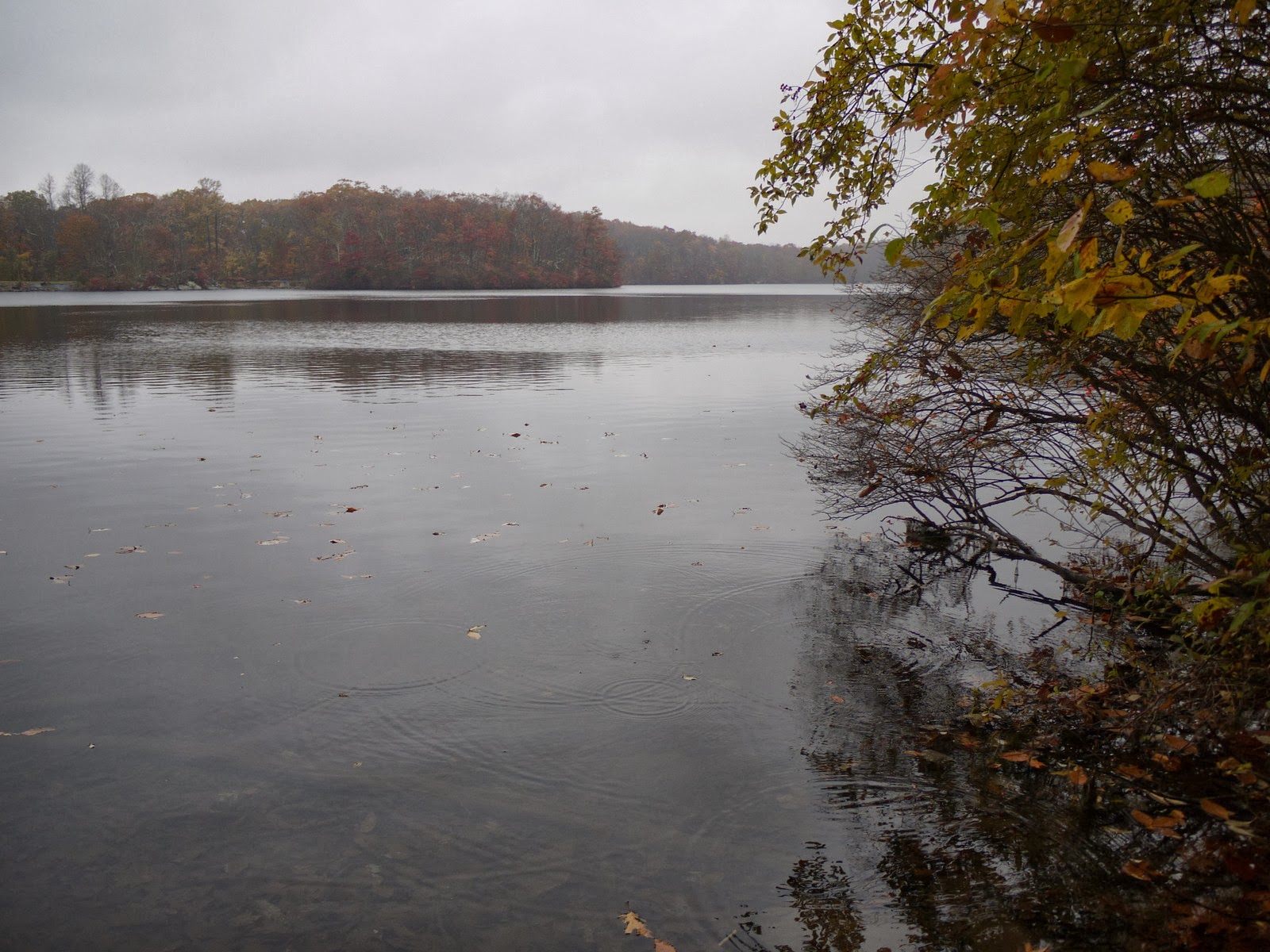
Miller's Pond
 The blazes were pretty faded, but people had been walking the trail the previous weekend and it was possible to discern the tread with with all the freshly fallen leaves. Eventually Miller's Pond came into view and the trail descended a rocky bank to the water's edge, where someone had left a kind note to hikers.

Will wearing blaze orange help??

Miller's Pond State Park
The sunny, warm fall day was beginning to cloud over, and by the time I got back to Bear Rock, the sky was getting pretty moody. On the plus side, the absence of sun glare made the colors really stand out.

Moody sky

Looking towards Reed's Gap (Rt 68)

Thursday, October 17, 2013

Coginchaug Cave, Durham

Leaves changing color
Chestnut sapling
This next section of the NET spur runs 2.3 miles from Old Blue Hills Road to Higganum Road in Durham (remember to check the location feature at the bottom of this post to see the exact parking location on a map). The CFPA showed two features: Coginchaug Cave and Pine Knob Overlook.  

Coginchaug Cave - see dog for scale
In Connecticut, a large rocky hill is called a "mountain", and a large overhanging rock is called a "cave." Neither is technically true, but who cares?  This is the second largest cave I've seen in Connecticut, the largest being the Indian Council Caves along the Tunxis Trail.


Nice view from the cave

Looking back toward the mouth of the cave
Doll's Eyes Baneberry
Pine Knob Overlook was supposed to be off a spur trail just after the cave.  I missed the trail junction and headed towards Higganum Road. The hike was fairly uneventful. The woods were changing color and leaves starting to fall.

The trail was recently reblazed, and the new blazes were very, every crisp and neat. I mean, they were perfect. A lot of older blazes were covered over with gray spray paint, which I thought was odd since some of the eradicated blazes were in helpful locations.  Too many blazes can be unsightly, but not enough blazes make it hard to follow the trail without having to constantly stop and look around for it. It can be hard to get the right balance. I had to backtrack and mull about in one area for five or ten minutes because I just could not find the trail. Freshly
fallen leaves can really hide a trail, making the blazes more important.

Also, many of the old blazes were covered over and a new one painted just below it. Wrong height, or what? Blazes are supposed to be at eye level, but does six inches up the tree really make any difference?

Christmas Fern; new blaze painted right below an obscured blaze. 
.
Witch Hazel flower and seed pod
On the way back, I found the red/blue spur trail that lead to the Pine Knob Overlook and started up the slope towards a rocky knob. And all the sudden I came out on a street. A woman walking down the road saw me coming up the trail and asked if I was lost. I knew right away that the road must be new, and she confirmed it. "The overlook is in some guy's back yard now."  Great. I trudged back down the hill. No scenic vistas this trip.  But it was a lovely hike through peaceful woods, and I didn't even find any balloons.