Thursday, December 5, 2013

Reservoir Loop, Middletown

Asylum Reservoir #2
The forecast was for temps near 60°, with the sun coming out in the afternoon, but I got cool, moody fog instead. That's OK, fog can be fun to hike in. Also, it keeps the riff-raff out. No other hikers, ATVs, bikes, nothing but the sound of water dripping off the branches and some chickadees. 


Connecticut State Hospital -- "the asylum" -- est. 1866
There are several "Asylum" reservoirs, cleverly numbered from one to four. The reservoirs were built to supply water for Connecticut State Hospital, the state's first mental health facility, or "insane asylum" as they called it at the time.  The reservoirs were uphill from the sprawling facility, and could supply not only drinking water, but water under pressure to fight fires. 

The Mattabesett Trail follows the west shore of the reservoir with several overlooks of the reservoir and Hartford that were nothing but fog during this hike. I'll be back here again, hopefully before it snows, to finish up the spur, so I'll get another look. 

 
Lichens are greening up after the drought
Although I like hiking in the fog or on a misty day, the rock can be quite a hazard. There were no steep sections on this hike, but the rock doesn't have to be steep to cause a fall. The rock was coated with a slick layer of slime, and the going was very slow. 
This was very tough to get down.
 While laying out a trail, bare rock, like the one in the photo above, is very enticing for the route -- it's already cleared! -- but it's treacherous to walk down in wet weather. For the above photo, I chose to find a way around rather than hope my feet wouldn't slip on the slimy rock.
4.2 miles to the end of the NET Spur
The Reservoir Loop is made by turning right onto the blue/yellow trail at a sign. The blue/yellow trail was a much easier walk in the wet weather. Need to watch very carefully for the blazes, though. 
View from the blue/yellow trail
It's not all gray out there.
What a view
Old pegmatite quarry
We're getting closer to the heart of Connecticut's pegmatite district, and the trail passed along the top of an old quarry.  The trail above was littered with countless shards of quartz. The colonial miners were probably looking for feldspar to use in ceramics. 

Chunk of pegmatite: white feldspar, gray quartz, black biotite, silver muscovite 

The Journey Begins in the Driveway

Sikorsky's factory in Stratford, where they make Black Hawk helicopters.
Although the New England Trail feels remote, it's really a suburban trail with almost nowhere to camp legally, so the typical hiker is not a backpacking thru-hiker, but a dayhiker like myself.  If your goal is to dayhike the entire trail, driving will be a significant part of the experience.  On the plus side, you will find yourself driving through towns and along roads you never gave a second thought to previously, and saying things like, "Oh, so this is what Durham looks like," or "Northford?? What is Northford?"  To dayhike the New England Trail is to explore the string of towns the trail crosses. 

West Rock Tunnel on the Wilbur Cross in New Haven
For the NET spur, I've found a particular route I enjoy driving, one that gets me off the expressway and lets me see Connecticut. Google emphatically tells me to go north up the Wilbur Cross and I-91 all the way to Berlin and then back south on the expressway Route 9 through downtown Middletown. Ugh. What's the point? To save a few minutes of driving, assuming there are no accidents on the highway?  

Accident shuts down the highway in Hamden.  

So I stay on the Wilbur Cross just until Exit 63 in North Haven and then follow Rt 22 east to Rt 17 north.  I like Rt 17.  It's a picturesque two-lane highway with little traffic and few lights. The GPS Droid Lady on my phone goes apoplectic at times, frantically trying to reroute me back to the fastest, crappiest route. I make her shut up with the volume button and ramble on down the road listening to my favorite tunes. 
I like Route 17 through Durham
Old barn along Rt 17
Turning onto Higganum Road
Another road I've grown fond of is Higganum Road, which heads straight east from Route 17, crossing the flat floor of the Connecticut Valley, with farmland on either side, until it abruptly starts winding up the forested hillside of the Eastern Highlands. 
Higganum Road crossing the Connecticut Valley floor
After reaching the plateau, Higganum Road continues on and turns into Candlewood Hill Road, with more farms, woods, and the occasional house. This is sooo much better than I-91. 
Candlewood Hill Road

Remember, this is one of the most densely populated parts of the country. 

Local color: painted rock on Candlewood Hill Road in Higganum
Old mill building in Higganum and town center, Candlewood Hill Road
After this drive, which takes about an hour for me, I'm ready to hike! 

Monday, November 11, 2013

Bear Hill and the Great Wall of China, Middletown


Back at it, trying to finish up the NET spur before winter. What a difference a week makes!  Nearly all the leaves were down,  and going up or down hills on the slick oak leaves felt like walking on a couple inches of snow at times, except it was a lot noisier. I wore blaze orange again, but if there were any hunters out there I'm sure they heard me crunching through the leaves long before they saw me. 

Typical metamorphic 'crap rock' of Connecticut (gneiss/schist)

I pulled off the side of Aircraft Road at the trail crossing, and before too long was already up on a small cliff with an overlook down into the leafless woods. The outcrop was the typical gray gneiss/schist 'crap rock' you see nearly everywhere in eastern and western Connecticut (but not in the Connecticut Valley).  That would soon change. The high points of the NET spur are high because they are a harder kind of rock: pegmatite. 

"Great Wall of China"
And there's the pegmatite, a long wall of massive white rock rising up from the forest floor. The CFPA CTWalkbook refers to this as the "Great Wall of China."  I vote that more trail features get names. It's fun to wonder what something like, "the Pavement" or "the Great Wall of China" will look like. The trail follows the bottom of the wall for awhile before suddenly turning and climbing to the top of it. 

View from the top of the Great Wall
The most exciting thing about the view at the top of the wall was the glimpse of the Connecticut River through the trees. It's the river that effectively ends the trail a few miles to the north. 
False summit
From this point on, it's all pegmatite under foot.  We are now in the Middletown Pegmatite District. Go ahead, Google it. The center of this district is near the very end of the trail, in an area called the White Rocks District.  The rocks are white (especially broken rock in a quarry) because the pegmatite has so many light-colored minerals in it. So I think I should say something about pegmatites here. 

Another false summit
Like the traprock of the mainline NET, pegmatites are igneous rock, meaning they were once molten magma. Very little of Connecticut is covered in igneous rock, yet a great majority of the NET has igneous rock underfoot. For me, the rock is a defining characteristic of the trail. It's a very large part of what makes the trail unique for Connecticut. The high ridges of trap rock and pegmatite were too rugged for farming or settlement, but they are great for modern hiking trails.


Blueberry or huckleberry still holding on to some color
Pegmatite - really hard rock
 Pegmatite is basically granite, but with really big crystals, sometimes several feet across (gemstones often come from pegmatites). The crystals were able to grow so large because the magma never got near the surface of the earth, and cooled very, very slowly. It's made up mostly of feldspar and quartz, and feldspar is mainly what it was quarried for in the Middletown Pegmatite District starting around 1825. Feldspar is crushed to use in ceramics. There are dozens of abandoned mines in the area. It's the feldspar that gives the rock that light color, along with the clear to gray quartz.


More pegmatite
And more pegmatite
There was a lot of walking along exposed ridges with great views before arriving at the summit of Bear Hill, where the views were not as great. So I took a photo of the USGS survey monument instead. 

Survey monument at the top of Bear Hill.
Of course. 

At this point I was pretty tired. I don't know if it was the backtracking for letterboxes, all the slippery leaves over the ups and downs, or the yardwork I did over the weekend. It felt like I had hiked 4 miles, yet the CFPA description says it's only 2.2 miles from Aircraft Road to the summit of Bear Hill. Fortunately, I was able to arrange for a ride from the opposite side of the hill, and the walk down was much quicker. 

Reindeer moss, the stuff that caribou eat up north in the tundra
The north side of Bear Hill has a LOT of mountain laurel. The trail was at tunnel through the laurel.  I can't imagine trying to bushwhack through that. And at one point there was an overlook to the north where I got a glimpse of Hartford shining in the sun, but it didn't photograph well. Then there was a glimpse of a reservoir down below, either Hubbard Pond or one of the Asylum Reservoirs that will be featured on the next leg of the trail. 
Almost there. A few oaks still have some color.
 
 Just before Bear Hill Road, there was one of the new NET signboards, complete with a tasteful map and QR code if you need to scan for a trail map. I plan to lobby our local Trails Committee to install some boards like this along our trails. Simple, yet looks good. 

I was hiking in a T-shirt all day and even though it was mid-November I was sweating up a storm.  As I arrived at Bear Hill Road and had to wait for my ride, raw winter weather began moving in and it started getting pretty chilly. I would not want to be stranded on that mountain overnight this time of year!  The next morning, I awoke to snow. 

Tuesday, November 5, 2013

Seven Falls State Park, Middletown/Haddam

Seven Falls State Park picnic area
Upon reaching Brainard Hill Road, the trail follows the roadway for quite awhile, crossing the expressway called Rt 9, to arrive at Seven Falls State Park. I experienced the road stretch in the best possible way, from the comfort of my car. A lot faster that way.  And I'd just like to mention that every town should have a "Nedobity Road." 

This is it?
Seven Falls State Park was not what I expected.  First of all, aside from a modest picnic area and parking lot, it was all woods. Which is fine with me, of course. Being a state park, I thought there might be more in the way of facilities. Upon doing some Googling at home, I found it listed as an "early roadside park" administered by the CT DOT.  That's different. According to the Haddam Historical Society, "The stop over was the state's first rest area and was extremely popular when Route 154 was the main road from Hartford/Middletown to the Connecticut shoreline." 

Second, I sort of assumed there would be some waterfalls, but there really weren't. Perhaps due to the drought, or maybe I just missed it. At the picnic area there is a prominent boulder field that Bible Rock Brook passes through, and I'm sure that's normally very lovely when there is more water in the brook, but it was down to a trickle when I visited (much of Connecticut is now officially in a drought). 

Leaves the color of pumpkin pie
I love November hiking. It's cool and crisp, no bugs, fewer crowds, and the views get better as the leaves fall. The freshly fallen leaves and occasional red berries hint of pumpkin pie and stuffing spiked with cranberries.  All I need now is a turkey running across my path.

Pin Cherry (?) under the powerlines. Or hanging cranberries, if you prefer. 
A major powerline corridor is a prominent feature of this park. I don't mind the powerlines for hiking. Sometimes they offer the best views of the day, and it's Connecticut, so what do you expect?  The blue blazes led us up and over rock knobs under the powerlines.

And the blazes say...trail goes up. 
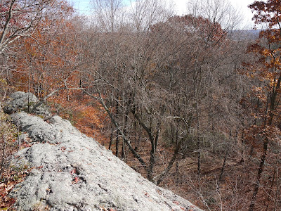
Rock. Lots of it. Rocky knobs, cliffs, overhangs. Rock underfoot. Dramatic rock. In summary, there is a lot of rock in this park. I suspect this area was never farmed much.  The going was slower than the previous hike as the trail wind up, over, and around all the rock.


A lone pine somehow manages to grow out of the rock.
After following the powerlines for a bit, the trail heads into woods filled with dramatic outcrops. It's normally to see some good outcrops on any hike in Connecticut, but this stretch of trail had more than it's fair share.

Just some more rock.

White Oak
Tree of the day: White Oak. It has light crackled bark, rather than the long dark furrows the oaks usually have. Plus, it often has "Smooth Patch Disease", a fungus that causes patches of the bark to fall away near the base.
Smooth Patch Disease - Common in White Oaks

Fewer leaves = more views
With all the fallen leaves on this rocky trail, my pair of trekking poles came in very handy.  I still managed to fall at one point when a leaf-covered cobble rolled under my foot. I would not do this hike in wet weather as the rock could be slick.

More rock...

Trail blazes lead straight up this rock
Highbush Blueberry

At one point the blazes led straight up a vertical rock face. As always, I thought it might be a joke. It never is. There were more blazes up on top. So I did what any reasonable non-goat person would do...I found a way around the rock. Judging from the beaten path around the rock, a lot of other people made the same choice.

Eventually the trail reached Aircraft Road, which would have been a lot more interesting if the road doubled as a landing strip.

Aircraft Road, sadly with no aircraft.
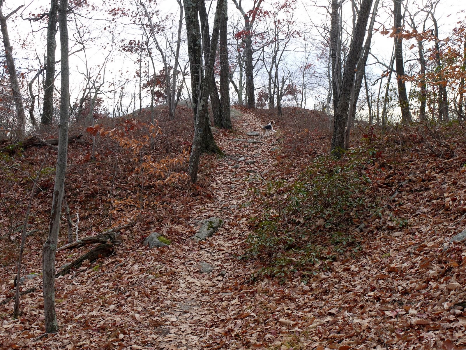
After reaching the road, I returned via the Seven Falls Loop Trail, blazed blue/yellow. The trail was easy enough to follow and some of the blazes were a little worn, but not too bad.
Dried up stream crossing


Although it was a school holiday, the only people I saw the entire day are in the above picture, way down below.  

I'll sign off with some shots of red berries.

Winterberry (native shrub)

Asiatic Bittersweet (a highly invasive vine)

Wintergreen