Tuesday, September 27, 2016

M-M Sections 8 - 9a End of the Metacomet Ridge


The Metacomet Ridge is in red.
Sections 8 -9a are at the very tip of it.
This is it - the end of the Metacomet Ridge with its high trap rock cliffs and broad valleys below - and it ends with a bang. The NET has followed the basalt ledges all the way from Totoket Mountain in Guilford, Connecticut to the Holyoke Range in Granby and Amhearst.  I've come to identify the NET as a trap rock trail, but from here to Mt Monadnack everything will be different. I'm a bit nostalgic during this hike. 

Section 8 in purple, Section 9a in red
We decide to do this piece in reverse and also include part of Section 9, starting on Bay Road and hiking west to the Notch Visitor Center, a hike that includes Long Mountain, Rattlesnake Knob, the Horse Caves, and the grand trap rock finale, Mt. Norwottuck, elevation 1106 ft. 

Rope assistance at Bay Road
Well, we got a good taste of  trap rock after only a few steps out of the car. The trail went straight up a basalt ledge and a rope was there to help. 


Trail Register
At the top was a mailbox functioning as a trail register. We signed in. These things can be fun to read.

The broken inner cover

The last people to sign the register
After about a mile of pleasant woodlands we crossed Harris Road and arrived at the east end of Section 8.  Five miles to go. The M-M Trail is co-aligned with the Robert Frost Trail in this area, blazed orange. The Robert Frost sounds like a great trail and I had toyed with the idea of following it instead of the NET in order to bypass all the road walks as well as the long Quabbin section where my hiking buddy and protector Quinn is prohibited. The Robert Frost trail heads north and is co-aligned with some older sections of M-M Trail. It would have been a huge detour, though, so I decided against it.


Trail benched in to trap rock cobbles
Granby - Amhearst boundary marker
We headed up Long Mountain first, the lower of the mountains today. There was a great view of Mt Norwottuck from the summit.

This was the first hike that felt like fall. It was wonderful. We had the hottest summer on record, and September was hot, too. But today was cool and cloudy with a chance of showers. It was also a weekday, so the trails were peaceful. We passed only a pair of trail runners and a mountain bike for the first few hours there on the "quiet side" of the Holyoke Range. It was such a relief after the barrage of trail runners and power walkers I had to keep stepping aside for during the last hike.


View west  from Long Mtn. Mt. Norwottuck in forground,
Mt Tom/Goat's Peak in background
It had rained recently (finally), so the woodland plants looked happier. No surface water anywhere, though.

Maple Leaf Viburnum, upper leaves probably damaged by drought

"End of Cuddeback Trail" at Rattlesnake Knob
The next high point was Rattlesnake Knob, reached via a short detour onto the Cuddeback Trail. I assume there was at least one rattlesnake here at one point, hence the name. Maybe there was a den of them. The Timber Rattlesnake is persecuted and only a handful of small populations survive in the state. There is a controversial proposal to create a home for rattlesnakes on an island in Quabbin Reservoir. I say go for it.

Rattlesnake Knob
Great views were to be had from the knob looking back at Long Mountain, the end of Metacomet Ridge. In the distance are the Eastern Uplands. The last time the trail was on the Eastern Uplands was in Guildford.

View of Long Mountain from Rattlesnake Knob
Polypody on Rattlesnake Knob
From there it's up and up to the Horse Caves and WOW, these are just amazing. We've got fun history and incredible geology all wrapped up in one crazy rock formation. 

Approaching the Horse Caves
Let's start with the history. Shay's Rebellion is one of those post-Revolutionary War rebellions that had to be squashed by government forces, and when it did, this is where some of the leaders supposedly hid with their horses. The farmers were rebelling against taxes and debt collection, and even tried to take over an arsenal. The rebellion was referenced quite a bit when the U.S. Constitution was debated.


The cliffs are several hundred yards long, with an unmarked trail running along the base. Follow it. Some of the best geological features of this formation cannot be seen from the NET. In particular, I'm talking about some arches and oval caves that are unlike anything I've ever seen in southern New England.


At first glance I wondered if they were man-made, but after studying the rocks a bit, it seems it's all natural. This was confirmed by a quick Google search at home, with sites simply referencing 'erosion'. But why would the rock erode into these shapes here and nowhere else along the Metacomet Ridge? The cliff was sculpted as if it where along the banks of a river, but it's not, and it doesn't look like it ever was.


The rock is mostly a conglomerate -- basically sandstone with some gravel -- that looks a bit like concrete. My best guess is that water seeps down from up above through some joints in the rock, coats the rock below, and causes spalling when it freezes. That's when the outer layer of rock pops off. Anyway, that's my theory. What's yours?

Crazy erosion for this area

This looks almost like a concrete pipe

Inside a small 'cave' with three sculpted openings
We had a lot of fun exploring the Horse Caves. Definitely one of my favorite spots on the NET. But eventually we had to scramble up a steep, narrow rock face and continue hiking upward until we reached the summit of Mount Norwottuck, the highest point along the Holyoke Range. It was a beautiful view looking back towards Long Mountain.

View from Mt. Norwottuck
We didn't linger because it was getting late and we had a lot of driving to do. On the way down the mountain, heading towards the Notch Visitor Center, we began to pass people going in the opposite direction, up the mountain. That's definitely the busier side of the mountain, and the trail is deeply eroded.


Approaching the Visitor Center, the trail skirts a quarry, but all you can see from the trail is a quarry sign that says 'no trespassing'. I'm told this section of trail used to be closer to the quarry and was recently rerouted away from it. The trail there was a nice looking section, going up the hills at an angle rather than straight up, and well-benched into the side of the hill. It's a lot of work building a trail like that, but it will be worth it in the end. 

This is probably the last day hike I'll be able to do while 'commuting' from my home in southwest Connecticut. It was dark at 6:00 am when I left the house in the morning, and it was dark when I got back at 7:00 pm. There was about 5 hours total drive time, including the Uber drive and stops to pick up a friend in Springfield. The traffic was horrible on I-91, as it always is. Future sectiona will need to be done differently, and by that I mean I need to step into the world of backpacking. 

Saturday, September 17, 2016

M-M Section 7b: Bare Mountain to Mt Holyoke

Heading up Bare Mountain
Saturday hiking! I avoid it at all costs. But we were up for the weekend, so I made the best of it and was on the trail by 7:00 am after driving through pea-soup fog in the river valley. My original plan was to start at the top of Mt Holyoke at the Summit House, but at the last moment realized the gates might not be open until 9:00 am. So I instead started at the ample parking on MA 116 for the Notch Visitor Center and did the hike in reverse. There were already half a dozen cars in the lot.

Art display on top of Bare Mountain
This section runs along the top of the Holyoke Range from Bare Mountain to Hitchcock Mtn, the Seven Sisters (a part of the ridge with lots of moderate ups and downs) and finally Mt. Holyoke and the Summit House. It's supposed to be one of the most grueling hikes, and it was.

An artwork display at the top of Bare Mountain was most unexpected. The sign below it said it was from the Eric Carle Museum of Picture Book Art.  "The Carle is pleased to present Brown Bear Everywhere. This outdoor exhibition celebrates the 50th anniversary of Eric Carle's first picture book, Brown Bear, Brown Bear, What Do You See? written by Bill Martin Jr.  This reproduction from the story is one of 14 images sited at public locations around Amhearst through October 10."


Brown Bear, Brown Bear, What Do You See?
I really enjoyed the display and vote for more trail art like this. Well done! I wasn't familiar with Eric Carle was or the Brown Bear book,  but one of his other books rang a bell: The Very Hungry Caterpillar. 

View from Bare Mountain 

Radio (?) Tower on Bare Mountain
There are lots of towers along the Metacomet Ridge: Cell towers, radio towers, fire towers, beacon towers, and tourist towers. They become landmarks. Sometimes you pass one that's a little different, like the one on Bare Mountain which I've seen referenced as a radio tower.


A pair of conduit pipes go right across the trail, and further on is a metal box with some folk wisdom on it.

I hope it's not me.

Section 7 is considered to be one of the most difficult parts of the M-M Trail, with lots of steep ups and downs, so I gave myself plenty of time and brought too much water. According to the NET website, there is 2633 feet uphill and 2311 feet downhill for the section, although I already completed the part between the river and the Summit House. It's not so much the total elevation changes as the steep, hazardous footing, that makes this section a challenge.

It looked to me like most of the steep inclines were really just caused by poor trail design rather than any constraint in the topography. Trails should avoid going straight down a steep slope unless there is no other option, and in this case it looked like there was plenty of opportunity to have the trail angle down the side of the hill, benched in.

Why does the trail go straight up the hill?
The design was causing a lot of erosion and some sections were really treacherous. I crept down some the steepest slopes very slowly using my trekking pole for added support and still managed to slip and fall on my butt when the soil shifted under my feet. Part of it was all that water in my pack throwing off my balance (I dumped some of it out later on), but trails should be designed for that. These are not cliff scrambles on rock. They are on loose dirt that rolls and gives way under your feet. It must be especially bad in November after the leaves fall.

This was the only set of stairs
I recently worked on rerouting a similarly steep section of a CT Blue-Blazed Trail with guidance from CFPA and was told the goal should be for the trail slope to be 8% or less, and also less than half the hill slope. If the hill has a slope of 8%, then you want a trail slope of no more than 4%. If the slope is 20%, you would try to keep the slope at 8% if possible (or use something like stairs). This is to prevent water from running down the trail and to increase hiker enjoyment of the trail.


From Mt Hitchcock looking towards Mt Holyoke
The people who like the super steep slopes are the fitness buffs, and they will object to any modification of the trail route to eliminate the steep sections. They enjoy conquering the challenges and obstacles. Which leads me to the worst part of this trail: It's just a big fitness track. Although I started at 7:00 am, I had to step off the trail over and over and over and over to allow trail runners and power walkers past. I bet I stepped aside 20 or 30 times.


The occasional runner isn't a problem. This was a steady stream. They ran alone, in pairs, or in groups, decked in spandex and often sporting headphones. They focused on their feet, not looking at the woods or the overlooks. Some didn't run, but traveled light in their exercise-wear, carrying nothing except a water bottle and power walking as fast as possible. It was clear they did this often and were just getting it over with so they could move on to the next thing on their to-do list for the day.  I did run across a few people actually hiking the trail, and they were also very disappointed with the swarm of fitness buffs. This is not a place for a relaxing nature hike, at least not on a Saturday.

View from the Seven Sisters
So I was basically just trying to get the hike over with because of all this fitness activity, rather than actually enjoying ridge. If your goal is to hike and get out in nature, then I would recommend doing this hike on a weekday if possible when the runners are hopefully at work.


Approaching Mt. Holyoke from the last of the Seven Sisters.
Mt Tom is in the background. 

The trail crosses the park road to the Summitt House at the bottom of Taylor's Notch.

Tiny feather
Nearing the Summit House, I spotted a tiny feather that looked like a miniaturized major hawk feather. I kept it as a souvenir to symbolize the slow savoring of a scenic trail and the little things the runners miss.

The Summit House picnic area

The plane crash memorial

Back to the Summit House
Since it was now Saturday, the Summit House was open. The first building here was constructed in 1821, and replaced with a larger structure in 1851. This was a hotel, and visitors could ride a steamship up the Connecticut River to a convenient train that carried them up the mountain to the hotel. What a difference a few decades makes.

Inside the Summit House
The most interesting thing in the building was the fire extinguisher, which was enormous. A metal plate on the fire extinguisher identified the product at "SODACID Fyr-Fyter" with direction to "WHEEL TO FIRE - OPEN VALVE ON CAP -- LOWER HANDLE TO GROUND."  I wonder if they ever had to use it. There was one on each floor.

Fire Extinguisher
For the second time in two days, my husband picked me up at the Summit House, this time after an 18-hole round of golf. We headed back to the Notch Visitor Center to pick up my car, and ventured into the little nature center for a look.


"The owls. Are not. What they appear." - a line from Twin Peaks. 
Everybody loves a diorama, including a miniature Holyoke Range under glass. I tried to identify the seven peaks of the Seven Sisters. I still can't do it. Afterwords, we headed back to the hotel for showers and a rest, then headed out for some dinner and shopping in Northampton, followed by the movie The Revenant on HBO.  The next day we left, but not before spending half a day at the Big E. All in all, a great weekend.

Holyoke Range diorama

Friday, September 16, 2016

M-M Section 7a: Boat Launch to the Mt. Holyoke Summit House

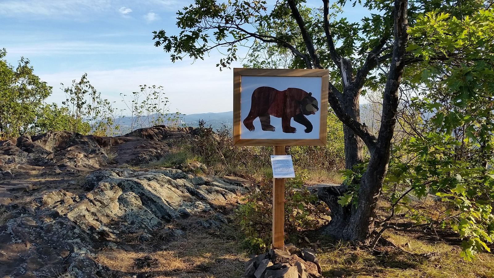
Section 7 along the Holyoke Range (from a trailhead sign)
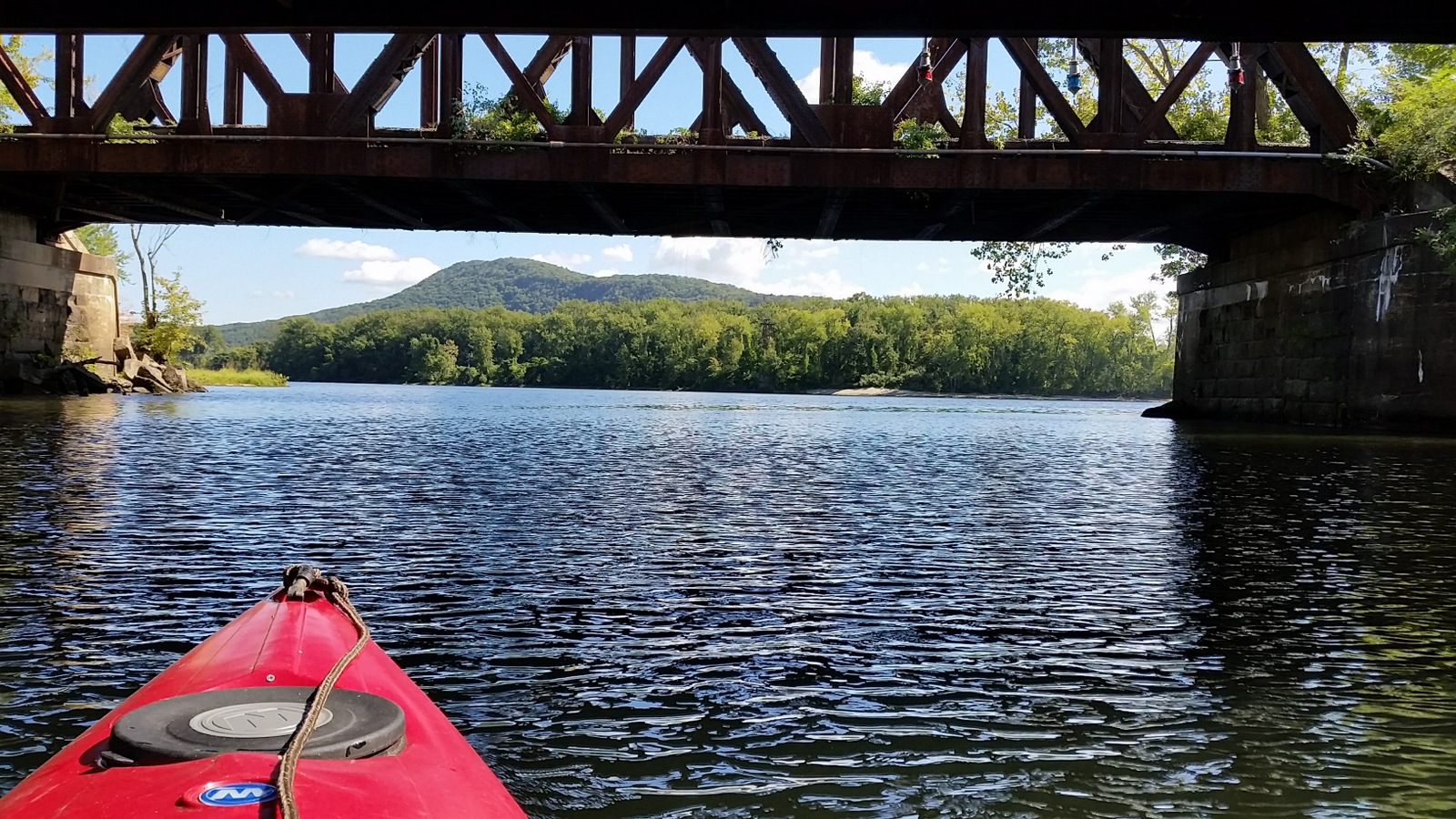
On a beautiful Friday morning, after exploring the Oxbow by kayak, we picked up my pack at the boat launch and set out across the Connecticut River. My goal for the day was only to climb to the Summit House on top of Mt. Holyoke, where my husband would pick me up. From the river to the summit! The hike is just over two miles, so I didn't expect it to take very long. ha ha ha ha


Heading out from the Oxbow to the Connecticut River
I like to define hiking success as having an adventure, and by that measure, this hike was a smashing success. There were some great parts, like the kayaking and the Summit House at the top of Mt. Holyoke. But I had a horrible time trying to get from the river to MA 47. If you're a thru hiker, find a different way than the way I went (the route described in the M-M guidebook 2005 edition). 


Crossing the Connecticut River
The river was gorgeous.  I stopped in the middle and just floated in the sun for about five minutes. No power boats. Completely peaceful.


M-M guidebook on where to land

The M-M Guidebook has a pretty clear description of where to land, and we had no trouble finding the sandy beach between the two sets of powerlines opposite the entrance to the oxbow. 


Sandy beach between two sets of powerlines

The landing, with Mt Tom Reservation in the background
The sandy beach was wonderful and we regretted not having a picnic lunch. It's obviously a party spot, and there was a lot of litter washed up at the flood line, but it was still really nice. But after a half hour or so, it was time for my husband to tow my kayak back to the boat ramp. Farewell!

My kayak getting towed back across the river
Now for the horrible part. I did my homework, studying the M-M guidebook map and description, and had the course mapped out on Google maps as well. I expected an overgrown trail, faded blazes, and some self-navigation, since this part is seldom used. I'm good with that. 


M-M Guidebook map (the book seam covers part of the map)

Screenshot of my Google map based on the M-M Guidebook. 
But I was not prepared for the impenetrable, unbroken thicket that blocked my passage from the beach. The first section of "trail" is through a belt of woodland that is only about 350 feet wide at its maximum. This took me a good half hour at least to get through, and it was exhausting. I went up and down the beach between the two powerlines, trying first one way, then another and another, and each way was a solid wall of vines and bushes. I looked for blazes and found nothing. At one point I managed to find a way through a 40 foot section by walking on a fallen tree trunk that had crushed the vegetation. Thank goodness there weren't many briers or thorns. It would have been impossible.
What I actually hiked (yellow) Vs. the Guidebook route (blue)

Wall #1: The Thicket
I recently read a book about explorers in the Amazon and how it would take them forever just to walk ten feet. I didn't really understand that when I read it. Now I do. At one point I was trapped by Black Swallow-wort, which also goes by the name Dog Strangle Vine. I could hardly pull my trekking pole out of the stuff. It was crazy. By the time I staggered out of the thicket, I was exhausted.

Oh Thank God: The field.
But...it's a wall of corn.  Are you kidding me?
I was so happy to see the field. I took a right turn like my map said and walked to the powerlines. The map and description say to follow the powerlines across the field. But there was a wall of 7-foot tall corn in the way, planted in rows at right angles to the "trail." Again, this was absurd.  Not gonna happen.

Detouring along the field perimeter
Coincidentally, the farmer was out harvesting the corn, and had made a couple passes on the perimeter of the field. I went that way. If I had been there a day later, I probably could have walked right along the utility towers like the guidebook says. If I had been there a few hours earlier, I don't know if I would have been able to walk the perimeter of the field. C'est la vie. 

Corn harvesting on the "trail"
The field perimeter route added about half a mile to the walk, which was OK. I had the Google satellite view up on my phone, showing the M-M guidebook route, and knew the perimeter would eventually bring me back to the powerlines.  At one point I passed a lane with a view of the harvesters, who were headed my way, and I thought they would catch me and I would have to duck into the woods to avoid getting in the way of the equipment, but they turned the other way.

A lot of corn gets left on the ground
I've never walked through a cornfield right after harvest. A lot of corn gets left behind and attracts deer and turkey and other wildlife. The kernels were hard, so I guess this is corn was destined for animal feed.

Russell Cove
The field skirted Russell Cove and some ducks flew by. There were several animal runs from the field into the water. Otter? Muskrat?

Wall #3: The Loosestrife Field
Finally, the perimeter route circled back to the powerlines, which I was supposed to be hiking under. And guess what, there was now a wall of purple loosestrife to wade through. I triple-checked the map. The Third Wall. This would have been no big deal if I had long pants on, but in with the loosestrife was one of the smartweeds with small thorns, maybe Lady's Tearthumb. Little tiny scratches were added to the bigger scratches on my legs I got earlier trying to get through the thicket. But I got through it. That night my legs burned as if I had a sunburn. Just a heads up:  Purple loosestrife is a wetland plant, by the way, so I would think this gets wet, but I wasn't too worried during the drought.  It looks wet on the satellite image, too.

Looking back towards the cornfield. Joe Pye Weed in the foreground. 
And then I came to the Fourth Wall - ten foot tall cattails (no photo). I've never seen cattails so thick. I tried going through (no water with the drought) and that was impossible. So I veered right, found a way around it eventually. and a field of grass opened up with Highway MA47 up the hill. Yay!

MA 47 up ahead. 


I came out at Hockanum Cemetery and sat down to take a break. The cornfield didn't get a breeze at all, and it was hot walking even on a cool day. I glanced behind me and saw a 'no trespassing sign' at the edge of the cemetery where I had just come through. Oops. Well. The M-M map does show the trail route curving back behind the cemetery. But I doubt there was any trail there and it would have been impassible. 

Hockanum Cemetery
After a break, I headed through the cemetery towards the junction of MA 47 and Mountain Road. I failed to copy the right maps for the trailhead area in detail, and didn't know where the trail went from here. There were no white blazes anywhere. I finally pulled out the gps and checked the route I found online from a previous hiker, and discovered the trail went up Mountain Road for a bit. But no blazes at all.


In the cemetery
By the way, what did that hiker with the gps route do to get across the river? I remember reading something about confusion over the drop off point and getting dropped too far upstream. And that's what the gps showed, with the hiker following the northern powerline rather than the southern powerline. That accidental route, though longer, actually looks easier than what I did. The northern powerline looks like it has a road beneath it.

Oh Thank God. A blaze!! I see a blaze!!
I was never so happy to see a trailhead and white blazes. And what does that NET map show for the crossing, I wonder?


Trailhead Map of the NET
Well, it's slightly different at the beach, showing a more southerly entrance, but the rest of it is identical to the M-M Guidebook map. To be fair, the online NET map shows no trail at all between the boat launch and MA 47, nor does the NET fold out map I purchased. But still...we're getting mixed messages here about the trail.


Looking back down at the way I came.
So anyways, the trail headed up the mountain and the hike from here to the top was pleasant and uneventful. I passed no one on the trail until I neared the top.


Scenic Trail

Solomon Seal berries

Coming up to the Summit House

The Summit House is gorgeous. As are the views. The inside wasn't open when I was there on Friday, but the big wrap-around porch was. A road goes up to the top, so there were people up there enjoying the scenery. It was a great place to wait for my ride back to the hotel.


Nearby is a monument to a WWII era plane crash on the mountain that includes one of the propellers from the plane. The young men were training for the war when someone made an error in judgement and crashed into the mountain.


Mt Holyoke from the Northampton Quality Inn
Back at the hotel, we hung out on the deck for a bit overlooking Mt. Holyoke. Looking out beyond the construction zone and Shell gas station, we could see the Summit House. To the left is the Seven Sisters, a hike planned for the following day.  After a nice hot shower (sorry backpackers!) and a break to relax, we had a great dinner at the Northampton Brewery. Highly recommend it!