Tuesday, August 20, 2019

NH Appalachian Trail: Mt. Lincoln, Lafayette, and Garfield


Trees along the Franconia Ridge knocked over by storms
I got a rather lazy start in the morning (but still earlier than most of the college students, it would seem) and ambled back to the top of Franconia Ridge. But this time I turned left and headed north along the ridge towards Lafayette, excited to reach the timberline and walk along the ridge.


Monarch on some species of goldenrod
It was a very pleasant stroll along the forested ridgeline for about a mile or so, mostly level, and I only saw one hiker. A lot of trees appeared to have been hit with a big wind from the east at some point, which is not the prevailing wind direction, so it was probably a nor'easter or hurricane. Although it was in the trees, you could sense the land dropping off sharply on either side.


At the top of the ladder facing Liberty & Flume
After a spell, the land started rising again, and a ladder lead to the top of a rock with dramatic views to the south. Two matched peaks stood out: Mt. Liberty and Mt. Flume. Their profile would help orient me at future overlooks.
Bearberry
The next few miles were in the alpine zone and I had a lot of trouble making progress because I kept stopping to admire the unfamiliar plants. And the views, of course, always the views. There was lots of Bearberry, a plant I'm familiar with only because I purchased some for a native species garden, and the plant slowly died over the years. But it thrived up here, and was covered with berries. I'm going to assume bear eat these berries.

Alpine Bilberry
Another widespread low shrub with big blue berries was  (I believe) Alpine Bilberry, also known as Bog Blueberry, Northern Bilberry. This was a hard one to find any natural history on, because the Internet tubes and wires were clogged with the therapeutic uses for of bilberry.


Little Haystack

I kept heading uphill and arrived at a peak around 9:15 am. I thought it was Mt. Lincoln, but it turns out it was just Little Haystack. This peak barely even shows up as a peak on maps or profiles, but while hiking the ridge, it does feel like one. No sign indicated the peak, but a trail sign for Falling Waters Trail placed me on the map. Up head was another peak: Mt. Lincoln. 

Mt Lincoln up ahead
These peaks along the ridgeline always looked closer than they were. It looks like it should take twenty minutes to get there, but it was closer to 45 minutes. Granted, I stopped frequently for photos.

The weather had been most pleasant so far, but suddenly a gust came out of nowhere, and if I didn't have my trekking poles I'm pretty sure I would have been completely knocked over. There were a growing number of day hikers on this section and they were donning their jackets.

Pretend this is Old Man in the Mountain or something
The Old Man of the Mountain used to be located across the Notch from this area before it fell apart, and I could see how these rocks would form a face.


View across Franconia Notch: Kinsman peaks & Lonesome Lake
The wind died down quickly and the sun was quite warm due to the higher elevation. Day hikers were wearing shorts and no-sleave shirts, and sweating. Nearing elevation 5,000 ft, I bet it was even hotter down at the bottom of the valley.

Day hikers on Mt. Lincoln
Mt. Lincoln (elev. 5089 ft) was bustling with backpackers, some of them from Liberty Spring. I don't think they were thru hikers, but I'm not sure. A lot of people go on shorter backpacking trips in this area.   Seemed like a lot of college kids.

Mt Lafayette directly ahead, Garfield beyond. Nice landslide. 
Mt. Lafayette first became visible from the summit of Mt. Lincoln. It looked really close, but took longer than expected to reach. By this time, I was starting to see a lot of day hikers in very good shape.

Mt. Lafeyette summit
I climbed up onto the somewhat crowded summit around 11:15. Top of the world! At elevation 5260 ft, Lafayette is just twenty feet short of one mile high, and is the highest point on my route between Long Island Sound and the Canadian border. What a great feeling!

Looking north across the gentle Connecticut River Valley
I did not realize it at the time, but the air is a bit thinner up here for those of us who live near sea level. At 5,000 ft, there are reportedly 7% fewer oxygen molecule in every breath of air you take in. So I think I can say that 7% of my gasping up the hills was due to thin air, right?

Mt. Lafayette summit
All in all, the weather was really nice for the ridge line and about as good as one could expect, though at the time I found the sun quite intense and the uphills hot and tiring.  I was wishing for some of that cold breeze to return. I was also concerned about sunburn in case I missed a spot with the sunscreen. The thin air seemed to make the sun's rays stronger.

Meet my friend, the Majestic Longhorned Beetle
Hanging out at the summit, a big dramatic beetle flew in and landed on my boot. It crawled around  on my boot for a couple of minutes, then on the rocks.  Looking it up later, I found it's called the Majestic Longhorned Beetle.

Heading down Lafayette with Mt. Garfield directly ahead. 
I didn't stay at the top very long as it was pretty busy up there, but started down the north shoulder of Lafayette. The trail suddenly got very quiet here, with just a trickle of backpackers. I passed a woman having lunch on a boulder. "Nice and peaceful here," I said. "Exactly!" she laughed. A bit further on, still above treeline, I did the same thing. Lunch time. It was gorgeous.

Mt. Garfield ahead. It doesn't look like very much from up above heh heh
I picked my way down the rocky hill, in no particular hurry, with the trail gradually circling to the East off of the Franconia Range and onward towards Mt. Garfield and the Twin Range (or Ridge). Had a nice conversation with a woman who had backpacked in with her dog, set up camp on the back side of Garfield Pond, and day hiked up to the top of Lafayette. Said she did it every year, and said there was plenty more room near the pond there. I thought about it. But when I got to the pond it was only 2:45 pm. Lots of daylight left, and I wanted to get closer to Zealand.

Garfield Pond
My water was getting low. I started with 2.5 liters, but with the heat and maybe the thinner air, I only had about half a liter left. I halfheartedly tried to get some from the pond, but the mud was so deep along the shore it didn't seem worth it. Later I heard from a number of thru-hikers who were completely out of water and did manage to refill at the pond.

Heading up Garfield
Garfield kicked my butt. By this time I was probably dehydrated, not to mention hot and tired, and the air was a bit thinner. The uphill was relentless, about 800 feet, and thru-hikers started speeding past me. I was actually getting shaky and light-headed, probably from dehydration. The afternoon sun was beating down on the west-facing slope and my thighs burned. But eventually I made it near the top to a great overlook.

Near the top of Garfield, looking back at Flume, Liberty, Lincoln, and Lafayette
Just a bit further was the summit. I didn't stay long, since there was a group of loud thru-hikers monopolizing the top.

Mt. Garfield summit
There was a great view of the Pemigewasset Wilderness down below, basically a broad valley with prominent hill in the middle called Owl's Head, not to be confused with the Owl's Head peak on Cherry Mountain. The Pemi Wilderness is 45,000 acres surrounded on three sides by the Franconia, Twin, and Bond Ranges. It reminded me a giant volcanic caldera.


The Pemi Wilderness from Mt. Garfield. 
It was a short but rather steep downhill to the Garfield Ridge campsite. The camp is located up a spur trail at a spring, and that noisy group of thru-hikers was there. After filling up a couple bottles (I drank the first so fast I got a brain freeze from the cold spring water), I headed up the spur and asked the caretaker for a quiet spot away from the noisy hikers that were coming up behind me. He brought me down to the farthest platform, which was wonderful, and I set up the tent.

The Caretaker Tent
The young thru-hikers were making a lot of noise, so I head back down to the spring to wash up and get some more water. An older thru hiker was waiting for a friend there at the spring. He said he was hiking southbound. He'd down the first half of the trail northbound, then drove on up to Maine and started southbound. This is an option a number of people do who want more time, especially retired people. That was interesting. On our last hike, we had passed some AT thru hikers heading south, and wondered how that worked. 

Overlook rock on the way back to the spring

Back in the camp, there is a common area near the bear boxes where everyone is asked to cook and eat their food, so any bears will look there and not sniff around the tents. This was the big hang out location for what I'm guessing are the so-called "Mayflies." Those are thru hikers who start late in May and then have to rush up the trail trying to get to Katahdin before winter. Someone just graduating from college, for example, can't start until classes end, typically in May.

I grabbed my supplies and cooked up some dinner while listening to the thru-hikers. They all knew each other pretty well it seemed and there were a lot of running jokes. As I was heading towards the cooking area, the caretaker had brought down another hiker to set up a tent next to mine on the same platform. I never got a chance to talk to her. I was eating my food when she came up to the cooking area, and was warmly greeted by her fellow through hikers. There was basically one big circle of thru hikers having a conversation that I didn't want to intrude upon, so I did like an anthropologist and just listened to this species of hiker.


Three bear boxes and a shelter
After dinner, I headed back to the tent. It was dusk, so I retired. My platform-mate didn't come down for another half hour or so, heading straight into her tend. So that was a little weird. She was very nice a quiet, and I tried to be the same. 

Monday, August 19, 2019

NH Appalachian Trail: Mt. Liberty


A.T. access starts on the White House Trail from the Liberty Spring parking area.
Time to climb up and along the Franconia Range! This was easily the most challenging hike so far, and it needed to be backpacked. My goal was to start at Franconia Notch off of I-93 where I left off last time, climb up to the ridge and cross the peaks of Mt. Lincoln, Lafayette, Garfield, South Twin, Guyot, and Zealand, all 4,000-footers, before descending the ridge down to Zealand Trail, where I would leave the A.T. and head towards the Cohos Trail.  I allowed four days, which included the long drive up from Connecticut.

Hobblebush
I decided I had to start on a weekday in order to get a parking space at the Liberty Spring parking lot, so when I arrive at 11:30 am on a Monday morning, there were no problems parking. This is apparently a very popular spot for thru hikers to take a break from the trail. They grab a shuttle into Lincoln and spend the next day (a "zero day") doing laundry and restocking their packs. They then arrive back a day later, clean and refreshed. But I didn't see any thru hikers on my first day. They undoubtedly had an earlier start and were long gone before I parked my car.
Franconia Notch Bike Path
There was a surprising lack of signs telling you which way to the A.T. considering that most thru-hikers appear to be using this parking area to grab a ride. The trail map in my pocket showed the short access trails, but not the names of the trails. So I didn't realize that the access trail I needed was called "White House Trail," until after I got home and started looking at my photos. But there were    arrows pointing towards Liberty Spring Trail, and my map did have that labeled as part of the A.T., so was able to follow the arrows. Along the A.T. in the Whites, there are a number of locations with great trail signs that do not mention the Appalachian Trail. You're supposed to know the local name of the trail and go with that. In reality, local trail names are just another thing to juggle and keep track of when you're trying to make time, so a number of these signs have had "A.T." added after the fact, sometimes scratched into the wood, sometimes with paint, and other times with a Sharpie.

The Whitehouse Trail joined the Franconia Notch Bike Path for a very short ways, then crossed the Pemigewasset River where I left off last time (this is now also the A.T.), and then took a right onto Liberty Spring Trail and started up the mountain.

The big loop everyone was doing
It was very hot and steamy. The forecast was for potentially record-breaking heat, and my glasses spontaneously fogged up for no reason. I prayed that it would cool down as I climbed the mountain, and started up slowly.

Passing the junction with the Flume Side Trail, I didn't realize that this is a very popular two-day backpacking loop, and that most of the people I would see that day would be doing the loop. They go up the Flume Slide Trail, scale Mt. Flume and then Mt. Liberty, and spend the night at Liberty Spring Camp before descending down the Liberty Spring Trail the next day. Mostly it appeared to be college kids getting one last adventure in before school started. 

Wonderful water on a very hot day
After climbing about 700 feet, which felt like more due to the heat, the trail crossed a nice clear brook, a great spot to take a break and cool down. A few bright red maple leaves decorated the brook. Let it be fall!


Hot and sultry but with a hint of fall
It did get a bit cooler and less oppressive above the stream (elevation 2100), but not by much. Every so often there was a wisp of a breeze. The uphill was technically very easy. No decisions to make, no scrambles, just a steady boulder to boulder climb that went on and on in the heat.

Up, up, up, up.....
It steepened after that, going up another 1700 feet. There weren't many hikers on the way up.

Finally
I took it very slow. There was no rush, since I needed to camp at Liberty Spring and wait until the next morning to really start hiking. The next tenting site after Liberty Spring was on the far side of Mt. Lafayette, another seven miles, and it would be reckless for me to try to make it when I didn't even start hiking until 11:30.  So it was nearly 3:00 pm before I arrived at Liberty Spring.


Singles only get half a platform.
This was the first camp I'd stayed at with an attendant and wooden platforms. I paid the attendant $10 and he told me the rules, then let me go find a platform. If you're in a single tent, you only get half of the platform in case someone else rolls in and needs the spot. I was lucky. No one took the other half of the platform.

Creative staking
My tent is only partially free-standing, so it was a challenge to set up on the wooden platform. I used a variety of techniques to stake the tent, and had to cut some extra pieces of string here and there.

More creative staking
After getting the tent set up, I wandered over to the spring. It was most adorable spring I've ever seen. It trickled down a piece of notched wood lined with carefully overlapping leaves. There was often a line at the spring because it flowed so slowly and everyone was so hot and thirsty.

I only saw one spring. I mention this because the name of the camp and the trail is sometimes plural and sometimes not. The camp diagram had the plural form, while the trail signs had it singular. Officially, I'm pretty sure it's the singular Liberty Spring. But it's often called the plural "Liberty Springs," which I think is just some tick people have with wanting to add an "s" at the end.  This seems to happen a lot with place names for some reason.

Liberty Spring.
After filling up and filtering plenty of water for the next day, I grabbed the sandwich I brought up and headed up the trail to the top of the ridge, then took a right towards Mt. Liberty. It's a short spur off of the Appalachian Trail.
On the ridge heading towards the Mt. Liberty summit
It was a delight to walk along the ridge line sans the heavy pack, and it was cooling down as well. It didn't take long to get to the top of Mt. Liberty. This is the peak with the perfect pyramid shape when seen from below. The views were breath-taking, and there were only a few passing hikers heading in the opposite direction, towards Liberty Spring Camp. So I mostly had the place to myself. I sat down and ate my sandwich and enjoyed the view.

Looking south-ish down the notch and I-93
From the top you could vaguely see I-93 far below as it ran through Franconia Notch. Across the notch were North and South Kinsman and Mt. Moosilauke beyond them.

North and South Kinsman to the west, the previous hike
The view to the north consists of the ridge and peaks I'd be hiking over the next few days. The route would follow the ridgeline in a semi-circle above the Pemi Wilderness. To the left was the ridgeline with Mt. Lincoln and Lafayette, then Mt. Garfield stood solo to the right, and finally the long ridge heading east with North Twin, Guyot, and Zealand. Wow. Below them all was the Pemigewesett Wilderness.

Looking north towards Lincoln/Lafayette, Garfield (center),
 and the A.T. ridgeline beyond (South Twin - Zealand)
Back at camp, I grabbed some more water and explored the site. It's oriented along a pretty steep hill, and the platforms were necessary to created level sites. There were a number of larger shared tents. Most of the campers were college-aged and enjoying their dinners. I saw piles of pots and pans. These were not your typical backpackers. They were kids having an adventure and making do with whatever materials they could get their hands on.

Pee in the woods
Although the sites were spread out well, and I had chosen one on the far end, some of my neighbors were pretty loud. Groups of boys. It really wasn't a problem until it got dark and I went in my tent and tried to read a book. It was impossible to concentrate. I put on my ear plugs and sleep phone (they play white noise), but even then I still heard boisterous laughing cutting through the night. It was annoying. I wish the caretaker would have said something to them. But eventually they quieted down, around 10:00 pm and I was able to go to sleep.

Platforms were well-spaced

Monday, August 12, 2019

NH Appalachian Trail: Kinsman Mountain


The Kinsman section of the A.T.
Amanita sp.
After a month of Connecticut heat and humidity, work, and random issues like a root canal and chopping the tip of my finger off, I was finally able to get back on the trail, this time with my friend Sarah.  This was supposed to be the relatively easy section sandwiched between Moosilauke and Franconia Ridge, but it turned out to be pretty epic, in large part due to a lot of driving each day.

I left southern Connecticut at 6:00 am on Sunday morning for a 10:30 am rendezvous in Franconia Notch at the Liberty Spring parking area. This is an extremely popular hiking area, and the big hiker parking lot was packed completely full, with cars parked up on the grassy shoulders. Not a space anywhere. I hadn't considered this possibility (although it seems pretty obvious now). For most of my hiking up from Long Island Sound I've been parking in tiny pull-offs at little-known trailheads, The White Mountains are radically different and far more popular, though, and it appears everyone beat us to the lot. But I drive a tiny car, and after taking a second look, I managed to wedge myself in between cars, only partly on the pavement.  Nice.  

The Clintonia had formed berries ("Blue Bead Lily")
My friend pulled in shortly after that and we drove over to the Beaver Brook parking lot at the base of Mt. Moosilauke. There's a fee for parking in the lot, $5 per day, which is fair. That lot was also full, but there were a few spots on the grass still open. 

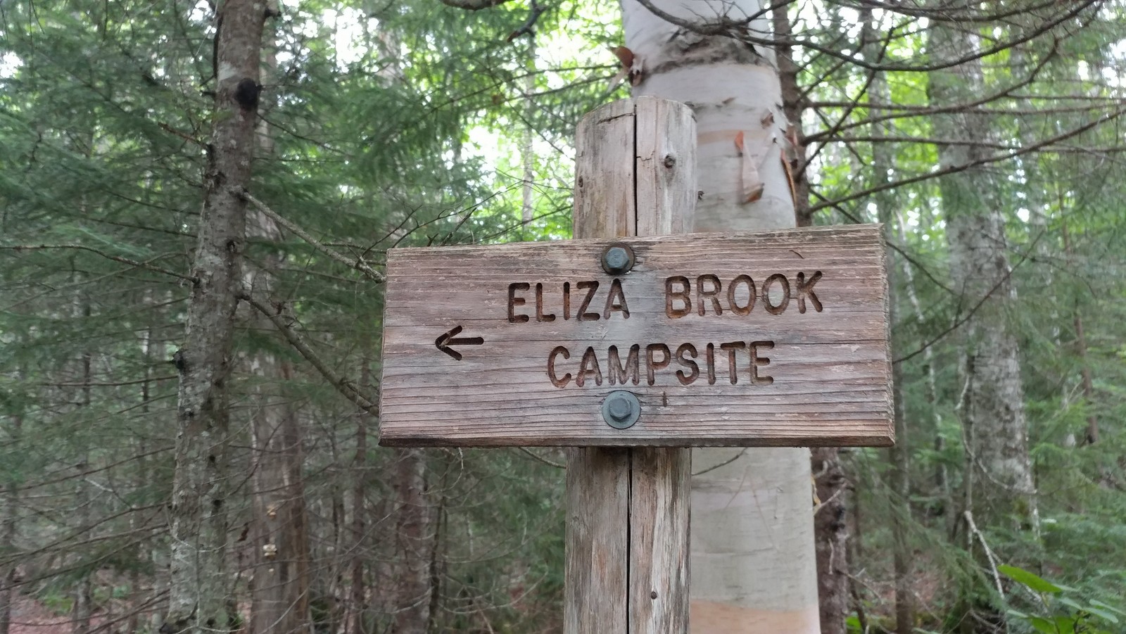
It was 11:15 am when we finally hoisted the packs onto our back and hit the trail. Phew.  Our goal was the Eliza Brook campsite, seven miles in. Seemed easy enough and we had plenty of time. The hike profile didn't look too difficult on paper. But it had been about six weeks since I carried a pack, a month since I'd been up in the White Mountains, and two weeks since I'd done any hiking at all (raging plantar fasciitis again, addressed with a cortizone shot to the heel).  It's amazing how quickly you fall out of shape. 


Finally on the trail!
The trail started uphill quickly from Route 112 and Kinsman Notch along some fine rock steps but eventually moderated into a series of ups and downs and false summits on our way to the top of Mount Wolf (elev. 3478).


Another wet trail in New Hampshire
It was a joy to be rambling down the trail in the north woods again, this time with a companion. The Clintonia (Blue Bead Lily) that had been blooming and covered with Canadian Swallowtails on Moosilauke a month ago was now in full "blue bead" mode with large berries. How quickly the seasons pass. Happy I was able to partake in the trail earlier in the season, even with the bugs.
Looking east towards Franconia Ridge from Mt. Wolf
Mt. Wolf became something of a running joke because we kept thinking we were there and we weren't.  But eventually we encountered another rise, this one marked with a sign pointing to an east-facing overlook. Franconia Ridge was getting closer.
Steeplebush Spirea under the powerlines
The ridge were were ascending is part of Kinsman Range, also called the Cannon-Kinsman Range, which runs between Kinsman Notch (where we started) and Franconia Notch. Mt. Wolf was the first and lowest of the peaks along this range. The range includes three "4,000 Footers": Kinsman South Peak (4358), Kinsman North Peak (4,293), and Cannon Mountain (4,080). We would be climbing all but Cannon Mountain on this trip.


View towards Lincoln and Woodstock from a powerline crossing
We weren't in any particular hurry, but kept a solid pace which turned out to be about one mile per hour.  So while it wasn't the most difficult section of trail, the footing was tricky enough to slow us down. The total elevation gain was about 2450 feet, with 930 feet of descent. Hikers were few and far between. I don't think we saw any day hikers. Only a few backpackers, and one or two people thru hiking the AT in reverse (southbound).

Eliza Brook Camp
The Eliza Brook campsite turned out to be a very nice one. It was a Sunday night, so the weekend warriors had abandoned the trail and there was only one other group there besides us. The hardened sites (no wood platforms yet!) were set above scenic Eliza Brook, which babbled nicely in the background. And there was nice spacing between the sites.


First bear box since Long Island Sound 
There was even a bear box (yay!). I believe this is the first one I've seen since I started this journey on the NET in Connecticut. So much easier than wandering around trying to find the right tree to hang a bag.

No bugs!
Best of all -- no bugs! None. I was able to lay down in my tent at dusk with my head sticking out just staring at the tree tops and wondering what that bird was that kept calling. Wood thrush?

The next morning we managed to get underway by around 7:00 am with the goal of getting to my car in Franconia Notch AND driving back home to Connecticut. It was eight miles to Franconia Notch and another half mile up an access trail to the parking area. That sounds reasonable, doesn't it? If we took too long, we could always find accommodations for the night, our Plan "B."

A bog!  Harrington Pond
Pitcher Plant and Sundew
The trail followed Eliza Brook up a ravine for almost a mile, with one waterfall after another. It was gorgeous. And then it climbed out of the dark ravine and before us was a sunny bog chock full of carnivorous plants. Another first for the NET-Cohos route. I bet there will be more in moose country. It was tricky getting through the mud in this section. Bog bridge planking was hidden an inch or two under the mud and water in places. Exploration with the trekking poles helped.

Getting up Kinsman's South Peak was tough
So that was slow-going, but the next hour and a half would kick our butts as we scrambled up the side of Kinsmen's South Peak. One scramble after another after another. You had to stop and ponder whether to go to the left or the right. Over and over until we were exhausted, physically and mentally. The views were great on the way up, though, so we were able to stop and enjoy them while gasping for breath.

Brunch on South Peak, Moosilauke in the distance
We were so happy to reach the top of South Peak, not the very top, but close enough, where it flattened out and opened up and proved to be a great spot to stop for a quick brunch while gazing out at Mt. Moosilauke in the distance. 

Mountain Cranberry on South Peak
The next part was a lot of fun as we walked through the krumholz near the treeline with views in many directions on our way to the Kinsman North Peak.

Hiking through the Kinsman Krumholz
It was here that we started seeing a lot of day hikers. A flood of them. Apparently they come up from Lonesome Lake, where many trails converge, and head on up to bag their 4,000 footers.


View east from the North Peak: Cannon Mtn to the left,
Lonesome Pond center, Franconia Ridge on the horizon. 
It was very steep going down to Lonesome Lake, but because it's so popular, the trail had been improved over the years with a variety of steps. It reminded me of Beaver Brook Trail, the one I went up instead of down.


Wood block steps bolted into bedrock
There were plenty of wood block steps that had been attached to the bedrock with rebar. There were toe-holds drilled into the rock. And of course there were plenty of impressive rock steps. It was wet and slick in some areas because that seems to be the way of New Hampshire, so that really slowed us down. Most areas didn't have the steps and you had to stop and make a decision about which way to get down. Sometimes it was a butt slide that made the most sense. Sometimes we would stand there and discuss it like we were a committee of two.  In the back of our minds the clock was ticking and we really did want to get home that day.
Toe holds drilled into steep bedrock
With the toe steps drilled in steep rock we pondered whether to go down backwards, just butt slide it, or be bold and use them as steps. I think all methods were used. Not sure which one was best.

Artistic wood block steps
A couple of the wood block steps were in disrepair and I could finally see how they were attached: two vertical iron pins drilled into the rock. Curiosity satisfied.

Lonesome Lake Hut
It was about 2:30 pm when we rolled into Lonesome Lake Hut. I had once thought of trying out the hut experience just to say I did it, and I thought it might be $40 or something, but they charge about $130 a night and require reservations. For that you get a meal, a bunk in a bunk room with a bunch of strangers, and use of the composting toilets in another building. I'll stick with my tent. But it's fun walking into the hut, filling up your water containers at the sink, and they usually have some snack food you can buy, like brownies.

Lonesome Lake, ironically named
After a good stop at Lonesome Lake (which had a dock of sorts and maybe a dozen people hanging out at the water's edge enjoying the sun and water), we decided it was time to get back to the car. It was almost 3:00 pm. Could we make it back home or would we need a motel? We had about three miles left to hike. It had taken us eight hours to hike 5.4 miles and that was going about as fast as we could go. We needed to go faster. We did. The trail grade eased up considerably, and though we were often still walking boulder to boulder or over uneven roots, we made good time.

I-93 crossing at the Pemigawasset River
I was never so happy to hear the sound of a highway as we approached I-93, which runs through Franconia Notch. The Appalachian Trail crosses under the highway along the shoreline of the Pemigawasset River. Just a bit further and we encounter a paved bike path that leads to the Flume. That was our turnoff. We took it a short ways and then saw a hiking trail go off to the right. The sign there just said something vague like "Trail to Parking." Which parking? The State of New Hampshire does not communicate very well. Just a couple more words on that sign could convey so much important information.  Their exit signs on I-93 just say "exit" with no additional info. Exit to what?? I had to stop and look it up on my Guthook App because we did not have time to take a wrong turn. Yup, that was it. The trail to Liberty Springs parking.

The total ascent for the day was about 3,000 feet and the descent was about 3600 feet.

We made it back to the car (and nearly empty parking lot - Mondays are apparently a much easier day to park) at around 4:30 pm. Phew. We still needed to go back and get the other car at the base of Mt. Moosilauke and drive home to Connecticut. We could do it! And did. It was a long drive back, but I got home around 9:30 pm and was able to sleep in my own bed for the night. Success! The hike was more rushed than I liked, but we did it. Next up: Franconia Ridge and the highest point of the NET-Cohos route.