 |
| The Kinsman section of the A.T. |
 |
| Amanita sp. |
After a month of Connecticut heat and humidity, work, and random issues like a root canal and chopping the tip of my finger off, I was finally able to get back on the trail, this time with my friend Sarah. This was supposed to be the relatively easy section sandwiched between Moosilauke and Franconia Ridge, but it turned out to be pretty epic, in large part due to a lot of driving each day.
I left southern Connecticut at 6:00 am on Sunday morning for a 10:30 am rendezvous in Franconia Notch at the Liberty Spring parking area. This is an extremely popular hiking area, and the big hiker parking lot was packed completely full, with cars parked up on the grassy shoulders. Not a space anywhere. I hadn't considered this possibility (although it seems pretty obvious now). For most of my hiking up from Long Island Sound I've been parking in tiny pull-offs at little-known trailheads, The White Mountains are radically different and far more popular, though, and it appears everyone beat us to the lot. But I drive a tiny car, and after taking a second look, I managed to wedge myself in between cars, only partly on the pavement. Nice.
 |
| The Clintonia had formed berries ("Blue Bead Lily") |
My friend pulled in shortly after that and we drove over to the Beaver Brook parking lot at the base of Mt. Moosilauke. There's a fee for parking in the lot, $5 per day, which is fair. That lot was also full, but there were a few spots on the grass still open.
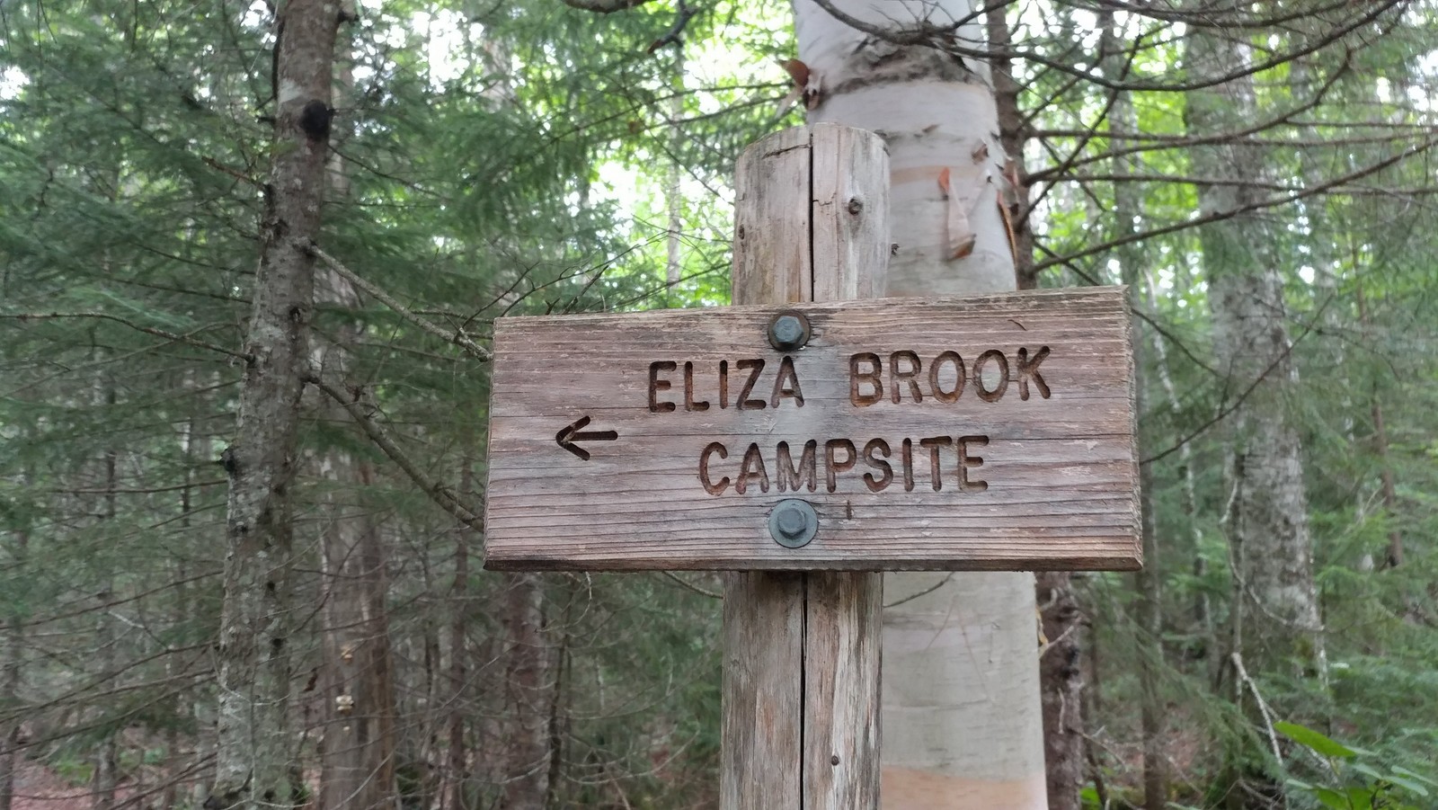
It was 11:15 am when we finally hoisted the packs onto our back and hit the trail. Phew. Our goal was the Eliza Brook campsite, seven miles in. Seemed easy enough and we had plenty of time. The hike profile didn't look too difficult on paper. But it had been about six weeks since I carried a pack, a month since I'd been up in the White Mountains, and two weeks since I'd done any hiking at all (raging plantar fasciitis again, addressed with a cortizone shot to the heel). It's amazing how quickly you fall out of shape.
 |
| Finally on the trail! |
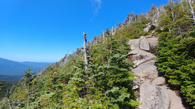
The trail started uphill quickly from Route 112 and Kinsman Notch along some fine rock steps but eventually moderated into a series of ups and downs and false summits on our way to the top of Mount Wolf (elev. 3478).
 |
| Another wet trail in New Hampshire |
It was a joy to be rambling down the trail in the north woods again, this time with a companion. The Clintonia (Blue Bead Lily) that had been blooming and covered with Canadian Swallowtails on Moosilauke a month ago was now in full "blue bead" mode with large berries. How quickly the seasons pass. Happy I was able to partake in the trail earlier in the season, even with the bugs.
 |
| Looking east towards Franconia Ridge from Mt. Wolf |
Mt. Wolf became something of a running joke because we kept thinking we were there and we weren't. But eventually we encountered another rise, this one marked with a sign pointing to an east-facing overlook. Franconia Ridge was getting closer.
 |
| Steeplebush Spirea under the powerlines |
The ridge were were ascending is part of Kinsman Range, also called the Cannon-Kinsman Range, which runs between Kinsman Notch (where we started) and Franconia Notch. Mt. Wolf was the first and lowest of the peaks along this range. The range includes three "4,000 Footers": Kinsman South Peak (4358), Kinsman North Peak (4,293), and Cannon Mountain (4,080). We would be climbing all but Cannon Mountain on this trip.
 |
| View towards Lincoln and Woodstock from a powerline crossing |
We weren't in any particular hurry, but kept a solid pace which turned out to be about one mile per hour. So while it wasn't the most difficult section of trail, the footing was tricky enough to slow us down. The total elevation gain was about 2450 feet, with 930 feet of descent. Hikers were few and far between. I don't think we saw any day hikers. Only a few backpackers, and one or two people thru hiking the AT in reverse (southbound).
 |
| Eliza Brook Camp |
The Eliza Brook campsite turned out to be a very nice one. It was a Sunday night, so the weekend warriors had abandoned the trail and there was only one other group there besides us. The hardened sites (no wood platforms yet!) were set above scenic Eliza Brook, which babbled nicely in the background. And there was nice spacing between the sites.
 |
| First bear box since Long Island Sound |
There was even a bear box (yay!). I believe this is the first one I've seen since I started this journey on the NET in Connecticut. So much easier than wandering around trying to find the right tree to hang a bag.
 |
| No bugs! |
Best of all -- no bugs! None. I was able to lay down in my tent at dusk with my head sticking out just staring at the tree tops and wondering what that bird was that kept calling. Wood thrush?
The next morning we managed to get underway by around 7:00 am with the goal of getting to my car in Franconia Notch AND driving back home to Connecticut. It was eight miles to Franconia Notch and another half mile up an access trail to the parking area. That sounds reasonable, doesn't it? If we took too long, we could always find accommodations for the night, our Plan "B."
 |
| A bog! Harrington Pond |
 |
| Pitcher Plant and Sundew |
The trail followed Eliza Brook up a ravine for almost a mile, with one waterfall after another. It was gorgeous. And then it climbed out of the dark ravine and before us was a sunny bog chock full of carnivorous plants. Another first for the NET-Cohos route. I bet there will be more in moose country. It was tricky getting through the mud in this section. Bog bridge planking was hidden an inch or two under the mud and water in places. Exploration with the trekking poles helped.
 |
| Getting up Kinsman's South Peak was tough |
So that was slow-going, but the next hour and a half would kick our butts as we scrambled up the side of Kinsmen's South Peak. One scramble after another after another. You had to stop and ponder whether to go to the left or the right. Over and over until we were exhausted, physically and mentally. The views were great on the way up, though, so we were able to stop and enjoy them while gasping for breath.
 |
| Brunch on South Peak, Moosilauke in the distance |
We were so happy to reach the top of South Peak, not the very top, but close enough, where it flattened out and opened up and proved to be a great spot to stop for a quick brunch while gazing out at Mt. Moosilauke in the distance.
 |
| Mountain Cranberry on South Peak |
The next part was a lot of fun as we walked through the krumholz near the treeline with views in many directions on our way to the Kinsman North Peak.
 |
| Hiking through the Kinsman Krumholz |
It was here that we started seeing a lot of day hikers. A flood of them. Apparently they come up from Lonesome Lake, where many trails converge, and head on up to bag their 4,000 footers.
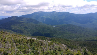 |
View east from the North Peak: Cannon Mtn to the left,
Lonesome Pond center, Franconia Ridge on the horizon. |
It was very steep going down to Lonesome Lake, but because it's so popular, the trail had been improved over the years with a variety of steps. It reminded me of Beaver Brook Trail, the one I went up instead of down.
 |
| Wood block steps bolted into bedrock |
There were plenty of wood block steps that had been attached to the bedrock with rebar. There were toe-holds drilled into the rock. And of course there were plenty of impressive rock steps. It was wet and slick in some areas because that seems to be the way of New Hampshire, so that really slowed us down. Most areas didn't have the steps and you had to stop and make a decision about which way to get down. Sometimes it was a butt slide that made the most sense. Sometimes we would stand there and discuss it like we were a committee of two. In the back of our minds the clock was ticking and we really did want to get home that day.
 |
| Toe holds drilled into steep bedrock |
With the toe steps drilled in steep rock we pondered whether to go down backwards, just butt slide it, or be bold and use them as steps. I think all methods were used. Not sure which one was best.
 |
| Artistic wood block steps |
A couple of the wood block steps were in disrepair and I could finally see how they were attached: two vertical iron pins drilled into the rock. Curiosity satisfied.
 |
| Lonesome Lake Hut |
It was about 2:30 pm when we rolled into Lonesome Lake Hut. I had once thought of trying out the hut experience just to say I did it, and I thought it might be $40 or something, but they charge about $130 a night and require reservations. For that you get a meal, a bunk in a bunk room with a bunch of strangers, and use of the composting toilets in another building. I'll stick with my tent. But it's fun walking into the hut, filling up your water containers at the sink, and they usually have some snack food you can buy, like brownies.
 |
| Lonesome Lake, ironically named |
After a good stop at Lonesome Lake (which had a dock of sorts and maybe a dozen people hanging out at the water's edge enjoying the sun and water), we decided it was time to get back to the car. It was almost 3:00 pm. Could we make it back home or would we need a motel? We had about three miles left to hike. It had taken us eight hours to hike 5.4 miles and that was going about as fast as we could go. We needed to go faster. We did. The trail grade eased up considerably, and though we were often still walking boulder to boulder or over uneven roots, we made good time.
 |
| I-93 crossing at the Pemigawasset River |
I was never so happy to hear the sound of a highway as we approached I-93, which runs through Franconia Notch. The Appalachian Trail crosses under the highway along the shoreline of the Pemigawasset River. Just a bit further and we encounter a paved bike path that leads to the Flume. That was our turnoff. We took it a short ways and then saw a hiking trail go off to the right. The sign there just said something vague like "Trail to Parking." Which parking? The State of New Hampshire does not communicate very well. Just a couple more words on that sign could convey so much important information. Their exit signs on I-93 just say "exit" with no additional info. Exit to what?? I had to stop and look it up on my Guthook App because we did not have time to take a wrong turn. Yup, that was it. The trail to Liberty Springs parking.
The total ascent for the day was about 3,000 feet and the descent was about 3600 feet.
We made it back to the car (and nearly empty parking lot - Mondays are apparently a much easier day to park) at around 4:30 pm. Phew. We still needed to go back and get the other car at the base of Mt. Moosilauke and drive home to Connecticut. We could do it! And did. It was a long drive back, but I got home around 9:30 pm and was able to sleep in my own bed for the night. Success! The hike was more rushed than I liked, but we did it. Next up: Franconia Ridge and the highest point of the NET-Cohos route.


No comments:
Post a Comment