Tuesday, September 21, 2021

Ghost Trail: Mt. Whiteface to Flat Mountain Pond

Heading up Mt. Whiteface on the Kate Sleeper Trail

This was the best day of backpacking. Perfect weather, no crowds, no bugs, amazing scenery, and the trail was just challenging enough to be interesting (and no more). And it ended with a bull moose grunting and scraping near my tent. Can't beat that. 

Cladonia Lichens near the summit
It was a pretty short and tranquil morning hike up Mt. Whiteface on the Kate Sleeper Trail/Rollins Trail from the col at the base of East Sleeper. I was surprised to find a dayhiker already up there. It was 9:00 am. This is a 4000-footer. All the 4000-footers have peakbaggers at their summits. 
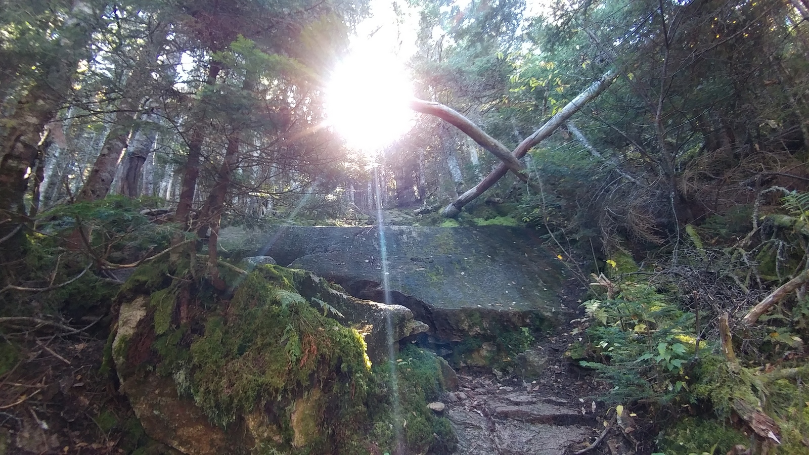
Mt.Whiteface summit

The views were great. I hadn't appreciated the view the prior day on Tripyramid because they are from the top of an almost-cliff I was about to descend in a state of near-terror. This was much more civilized. There were old carvings in the hard rock dating back to the 1800s. Graffiti is ageless. Cell phone was good, so I backed up some photos in case something happened to my phone before continuing on. The sign post for the McCrillis Trail was easy to miss, but I found it and followed the trail south down the mountain.

Mt. Whiteface view
After the Tripyramid trauma the previous day, I was worried about the Mt. Whiteface descent. It's all the same ridge, so presumably the same geology and the same mountain goats laying out the trails.  There did turn out to be one tricky part early in the descent where I played it safe and lowered my backpack with some rope before sliding down the rock on my butt. That was the only challenging spot for the day. 

The only tricky part of the day

Fearing the worst as I headed down this mountain, I was continually elated at each moderate descent. Steep, but not big scrambles. And dry. When the grade finally began to lessen and the worst was over, I was all smiles. The ridge was over with. Piece of cake. 


Reindeer moss and mushrooms, McCrillis Trail

Looking back at the Mt. Whiteface summit

Indian Cucumber, slopes of Mt. Whiteface

I passed a group of older men starting up the mountain as I arrived at the junction with Flat Mountain Pond Trail. And that was the last of human beings for the next two days. 

Whiteface River, Flat Mtn Pond Trail

Flat Mountain Pond Trail was a joy to hike. It follows the lovely Whiteface River gradually uphill for awhile before turning west towards Flat Mountain Pond. No need to carry much water. 


Red-Belted Polypore oozing water drops (guttation)

There were a ton of mushrooms decorating the trail, but the one that caught my eye was a bracket fungi growing on a tree that was covered with glistening drops of water on a completely dry day. I later learned that this is called guttation, and it's something some species do more often than others, helping with identification. The Red-Belted Polypore is well-known for guttating clear drops. Some other species ooze out colored drops. The Bleeding Tooth fungus oozes out drops that are blood red. 


Flat Mountain Pond

The walk along Flat Mountain Pond was lovely. Beautiful and peaceful. Bits of fall color. Ducks. Parts of the trail were super easy and other parts climbed up the steep slope above the pond and navigated boulder fields. 


Flat Mountain Pond inlet

There is a designated tenting area at Flat Mountain Pond Shelter, and it was very tempting. I hung out for ten or fifteen minutes pondering on whether to stay in this glorious spot or continue on a few more miles. 
Tenting site at Flat Mountain Pond

It was still early, so after taking in the view of the pond and the Tripyramid-Whiteface ridge behind it, I bid farewell to the pond and continued down the Flat Mountain Trail. 

Looking back towards the Sleepers and Tripyramids

From this point on, the trail followed an old railroad bed cut into the side of the hill, so it was nearly flat. Amazing how much work was done just building an infrastructure to haul out logs. After a few miles the cross slope eased up and it was easy to find a nice flat spot to tent for the night. 

Flat Mountain Pond Trail following an old logging RR line

After setting up the tent, I came upon a moose scraping while scouting for a spot to hang my bear bag. This was about 100 feet from the tent and looked pretty active. The moose tracks and scrape marks were obvious. Moose scrapings are where a bull moose scrapes the ground and urinates onto it, and then return to see if any females have been attracted (deer also make scrapings). Any chance the moose would return that night?


Moose scraping near my tent site

Yup! As soon as it was dark, I could hear the moose stamping and scraping, brush crashing, and so forth. The tent seemed pretty vulnerable for a charged up bull in excess of 1000 pounds, but I've never heard of a moose attacking a tent. I finally unzipped the tent and looked out with the headlamp, but there was too much brush and I couldn't see anything. The noise stopped, but maybe twenty minutes later he was back at it again. 

Monday, September 20, 2021

Ghost Trail: Kancamagus Highway to Mt. Whiteface

Lily Pond at the Livermore Trailhead

Welcome to the Ghost Trail Sobo Part 2.  The goal was to backpack from the Kancamagus Highway to Plymouth, where I'd get picked up by my husband for a long weekend escape in New Hampshire. Then I'd spend the next few days slackpacking to the base of the Cardigan trail system while he golfed. 

Livermore Trail begins

Day one was fairly ambitious for someone of my age and fitness level considering the dwindling number of daylight hours in late September, but I figured I could pull it off: A 5-hour drive followed by nine miles of hiking up and over the Tripyramids to the only water source up on the ridge, Downes Brook. It turned out to be more difficult than expected and I just barely made it.  

After the long drive, I was able to back into the Livermore Trailhead parking area, which is very small. No other cars.  There is a lot of parking space on the other side of the highway along Lily Pond. Check out the pond, if you have a chance. 


Climbing up towards Livermore Pass

It's a steady climb up to Livermore Pass at Mile 2.7. The terrain wasn't steep but was fairly tedious and slowed me down with all the slick mossy rocks.  There's a rustic sign unexpectedly marking the pass, where it levels off, and the next stretch is pure mooseland. Way more moose tracks than human tracks. I became convinced there would be a moose along the trail at any moment. There were a number of wet spots in this area to navigate, so all in all Livermore Trail took longer than expected, but it was enjoyable and the weather was perfect. 

Moose Central in through here

This hike was bookmarked by features named Livermore, with a brush past Mt. Livermore just before the roadwalk leading into Plymouth. There's a ghost town called Livermore not far from the previously hiked section of the Ghost Trail along Sawyer River Road. Livermore was a boomtown back in the 1800s when the White Mountains were being clear cut. At one point there were between 150 and 200 people living in the town, not including the loggers. There was a sawmill, of course, and extensive train track system crossing the area used to haul the logs to it. The old track system is the foundation of some of the hiking trails. Eventually they cut all the timber and that was it for the town. The AMC hiking map for the region shows the location of Livermore and there are a few ruins left if you want to check it out. 


Some bits of fall color along Livermore Trail

There are several potential water sources along this stretch. If you need to pitch a ground tent, the area just north of the junction with the Old Skidder Trail might work. There's a stream crossing. 

I chose to ascend Tripyramid the "easy" way by taking the Scaur Ridge Trail instead of the Tripyramid Trail. The latter just looks insane to me and it's listed as one of New Hampshire's most terrifying trails. A younger version of me dayhiking with friends would have loved it. You go up the North Slide, which is shear rock that's nearly vertical. All sources say to never, descend on this trail. So if you are northbound, you've been warned. Scaur Ridge Trail was a delightfully moderate walk up to a ridgeline, where you then hang a right onto the Pine Bend Brook Trail. 


Slime mold fruiting body mass inside an old Yellow Birch,
Scaur Ridge Trail
Close-up of young fruiting bodies
Hemitrichia calyculata? "Push Pin Slime Mold"


There were a ton of mushrooms on all my Ghost Trail hikes, but what really caught my eye was a Slime Mold on the Scaur Ridge Trail where a rotting birch had the appearance of splitting open to reveal bright orange teeth. Slime Molds are not related to mushrooms, but are instead a gelatinous amoebae that can move around a few feet to a better location on a log or rock to position their fruiting bodies.  In this case, the tough bark of a yellow birch kept the amoebae sealed inside, so it found a spot where the log broke in half to start fruiting. I walked by at exactly the right time. A few hours later, the young sporangia would change in appearance. In fact a common method of identification is to go back to a fruiting body every few hours to check its appearance over time. 


Pine Bend Brook Trail following the ridgeline

I was nearly to the top of North Tripyramid and things were going great. Pine Bend Brook Trail followed a sharp ridgeline, almost a knife's edge before heading up for the last section up the mountain. 

Pine Bend Brook Trail and the first of many scrambles

And then....it was one difficult, slick mossy scramble after another. I had not planned for this. I had too much water in my pack (in case I didn't make it to the brook for the night). Four days of heavy food. Too many things dangling off the back of my pack that could catch on things, including a pair of Crocs that at one point snagged on a branch as I was on my hands and knees trying to climb up through a narrow gap between two trees. I got stuck for a bit trying to figure out what was going on there. At another point I ripped my pants on a sharp branch. Yet another time I had to take off my pack and shove it up the rock, then careful get up and over it, and somehow get the overloaded pack back on while standing on a steeply sloping, damp and mossy ledge. I'd get up a ledge and think that was it, I'm done with that ledge stuff and then there would be another. And another. And another. I was so done with the ledges. 

Looking down one of the scrambles on the Pine Bend Brook Trail

They finally did end, of course. Why didn't any of the guidebooks mention all the difficult scrambles on this "easy" route up to the top? Most people are actually taking this route down the hill, not up, and they are dayhiking, not backpacking with tons of food and water. Completely different scenario. At any rate, the top of North Tripyramid was tiny, with no view or even a sign marking the spot. A couple peakbagging guys came up from the other side, ignored me, and continued on. 

Up on the Tripyramids

A passed a few more groups of men peakbagging as I followed Tripyramid Trail south to Middle and South Tripyramid. It was nice enough up there. No real views, but glimpses through the trees. A few spots where people have set up tents. 

Heading down the "Gravel Slide"

I'd read Mt. Tripyramid descends South Tri on the "Gravel Slide", and to "pick your way carefully" down the slide, which is supposed to be much easier than the North Slide. I was not mentally prepared for going down this slide. First, it's not gravel. Is there gravel down at the bottom or something? It's all ledge. Second, it's much longer and steeper than I expected. It's probably really easy going up. But I'm fairly afraid of heights, and looking down the endless slide with that heavy load on my back threatening to throw me off balance at any second was a real challenge. Did I mention my balance isn't very good? It happens as you get older. Thank goodness the rock was dry. 


I was too terrified going down the slide to enjoy the view

So I inched down this nerve-wracking trail, taking forever. I eagerly kept my eye out on the left for the Kate Sleeper Trail, which I'd read is easy to miss. 

Finally arriving at the Kate Sleeper Trail, thank goodness

Kate Sleeper Trail junction - easy to miss

I was ever so happy to finally arrive at the Kate Sleeper Trail. Done with the slide! And then....

Noooo! Another slide to inch down
Kate Sleeper Trail


Another slide to go down! What? Well, there was nothing for it but to forge ahead. These scrambles and slides had really slowed me down and it was getting late. At this point I was pretty sure I was not going to make it to Downes Brook before nightfall. The Tripyramids had kicked my butt.

It was so nice to stretch my legs up and over the two Sleepers

Happily, the Kate Sleeper Trail was a piece of cake as it slid up and over West Sleeper and East Sleeper. It was so nice to finally stretch my legs and just walk.  The sun was about to set while I was on East Sleeper and I was thinking of finding a spot to set up there, but the hilltop was a huge tangle of old blowdowns and new growth. Impossible. 


Made good time flying across the Sleepers

But the walk down the Sleeper was quick and I arrived at Downes Brook in col between East Sleeper and Mt. Whiteface just in time to throw up my tent and hang a bear bag before it was dark. Phew! I was so happy to crawl inside and lay down for the night.  The cell signal that I'd had up on the ridge was lost down in the col, but I was able to text my status using the Garmin Mini InReach. 

Arrived at the Downe's Brook area at sunset

In Conclusion: The Tripyramids would be easier backpacking in the northbound direction. Even so, allow extra time, especially in wet weather. Also, you might not want to even bother with the Tripyramids. Another hiker is planning on doing the Ghost Trail route by way of Mt. Passaconaway. Yet another option might be to explore the Downes Brook Trail all the way to Kancamagus Highway and Passaconaway Campground. That trail looked like it gets very little hiker traffic, at least the part I saw, which is in the spirit of the Cohos and Ghost Trail route. 

Monday, September 13, 2021

Ghost Trail: Carrigain Notch to Kancamagus Highway

Headed for Desolation Trail

Green-Capped
Jelly Baby
A beautiful day for hiking up Mt. Carrigain!  I started from the junction of Nancy Pond Trail and Carrigain Notch Trail and had an easy warm-up stroll to the Desolation Trail junction, which was another good spot for setting up a tent. I passed a group having breakfast. From this junction, it would be an easy 7-mile walk north through the Pemi Wilderness to Zealand Trail, and then on to the Cohos Trail if someone northbound was in a hurry to get to Canada and didn't mind skipping the bottom end of the Cohos and the Presidential Range. 


Desolation Trail

Desolation Trail is listed as one of New Hampshire's most terrifying trails, so I had taken extra time  packing and had removed all the dangly things off the back of my pack in case I needed to remove it. Got plenty of water at the trail junction, but planned to drink half of it and lighten the pack before doing the steep part, which is closer to the top.  

Ha, ha, ha.. that's the trail

It wasn't that bad. Going up, that is. It's the north side of the mountain and doesn't get used that much, so there are a lot of very damp, mossy boulders and some good drop-offs to the side. So it was very slow going. At one point I came around a curve and just started laughing. The trail went straight up a rockfall. It looked worse than it was. I was always able to find a place to put my foot or grab something with my hands. That's all I ask. But that was going uphill. At one point I dropped my trekking pole and it bounced back down the trail thirty feet. Going back down to get it was a completely different experience. I was on my butt, carefully sliding off of mossy boulders to get down. So if you are going northbound, give yourself plenty of time for this descent. 


Up in the Carrigain Tower

There's a tower up at the top that no one should ever skip during clear weather, and the views were just spectacular in every direction. It was much colder up above the trees and the wind was just blasting.  Very dramatic. I especially enjoyed looking back towards the Presidential Range and seeing the distinctive steps of Stairs Mountain, where I'd spent the night a few days back. 

There had been no cell phone service since the hillside just above Nancy Cascades, but there was service at top of Carrigain. Some guy came past, heading down Desolation Trail and talking on his phone, telling his listener that he was calling now because he didn't know how much longer he would have a signal. I think his service probably cut out after 5 or 10 seconds. 


Looking forward towards the Lakes Region
(from under the tower)

I could post a million photos here of the views from the tower, but that stuff is all over the Internet, so here's one looking forward (southbound towards the Lakes Region) and one looking back. 

Looking back towards the Presidential Range

There was a designated camping spot just below the summit. No water. The Ghost Trail follows the Signal Ridge Trail down the south side of Mt. Carrigain. This is the easier, more accessible trail going up the mountain for people climbing up to get a view or to check off another 4,000-footer. This was a Monday in September, but I still passed a number of day hikers on their way up. 

The first part of the Signal Ridge Trail was beautiful as it followed the ridgeline through stunted trees. This was the spot for taking a nice break (the tower was too cold and windy). And then there was long, tedious descent on an eroded popular trail. Water trickled out of the hillside in a few places, probably not a reliable source of water at all times. 


Signal Ridge Trail

My original plan was to take the mountain slow, camp at the bottom of Mt. Carrigain, and then the next day would be a leisurely stroll to my car spotted on the Kancamagus Highway. Then there would be the five-hour drive home with plenty of daylight. But I wasn't ready to stop when I got to the junction with Carrigain Notch Trail, so continued down the Signal Ridge Trail. You know, "just a bit further."


The shortcut not taken

There are two options for connecting the Signal Ridge Trail to the Sawyer River Trail. The safest bet was to stay on the Signal Ridge Trail all the way to Sawyer River Road, then walk along the gravel road to the Sawyer River Trailhead. But the maps showed an old road running alongside Carrigain Brook that might serve as a more direct route, eliminating the need for the long roadway, and that was my original plan. I found the old road OK, and started down it a few steps, but it didn't look like it got used much. There were trees across it and no tread. I imagined impassible swampy areas along the brook, or maybe the old road would just disappear, so I turned around and continued down Signal Ridge Trail, which at that point was super easy and I was flying. But shortly after that, the trail became more tedious, with a number of wet spots to pick through. And then the road walk was all uphill and seemed to take forever. 

Signal Ridge Trail junction with potential shortcut


Sawyer River Road

So when I finally passed the far end of that potential cut-off trail, I wished I'd at least tried it. If it's clear enough to walk, it would definitely be the better route. Here's a photo of the south end of the cutoff if anyone is nobo and wants to try it. It's pretty close to the end of Sawyer River Road and the parking area. There's a line of big boulders placed across the road and sign indicating no camping in that spot. 

Far end of that potential cut-off at Sawyer River Road
(sign says 'no camping')

The road finally ended at a good-sized parking lot which would have been the perfect place to leave my car if I had known it existed. 

Sawyer River Trail begins.

Sawyer River Trail runs for about four easy miles through lowlands to the Kancamagus Highway. Parts were along groomed snowmobile trails (probably old logging railroad beds) and were super easy. A few other parts were slower through muddy areas or fording brooks, and I had a least one occasion of trying to figure out which way the trail went. Mostly the footing was very good, though. There are a number of stream crossings here that look like they would be difficult in high water. Most of the trail is a bit of a blur because by this point I was trying to get to my car and just drive home that night and was going as fast as I could. I was thinking about canning tomatoes from the garden and stuff like that. 

Sawyer River Trail

So I did make it out to the highway a day early, and then had to walk uphill another 3/4 mile to my car shortly before sunset. It was a long, dark drive home back to Connecticut, getting home around 10 pm. Parking at the end of Sawyer River Road would have worked much better, and then the next trip I would have had a good walk to the base of Tripyramid after the five hour drive up, camping overnight and heading up Tripyramid fresh. That's not what happened, but that's another post. 


The Swift River