 |
| Cold War Redstone Missile in Warren |
 |
| More Americana |
This wasn't a very long hike, so let's start out with what is possibly the only missile on display in a public park. We passed it in Warren after spotting my car for some slackpacking. The missile is pretty big and hard to miss while passing through. This is where Routes 25 and 25C come together. Warren seemed like a nice little sleepy New England town, the type Stephen King likes to write about. After a joyous stop to consider this oddball piece of Americana, we continued up the road through heavy rain to where I had left off the day before. This is where the Appalachian Trail crosses 25C.
As we drove through the rain, I was pondering whether I should have hiked it the day before rather than saving this part of the trail for now. I had wanted something to do while my husband played a round of golf, but what the heck. As they say, there's no such thing as inclement weather, only improper dress, and I had rain gear. Also, it's called Mount Mist. Rain seemed appropriate. The forecast was for scattered showers and thunderstorms, possibly severe.
 |
| Nice and easy. |
It turned out to be great hiking weather for the end of June however. No more rain, and apparently it never rained very hard on the trail. This entire stretch of trail turned out to be a lot easier than the previous sections and it went fast with little effort.
 |
| The dramatic top of Mt. Mist |
Mt. Mist didn't have much to it. It was a gradual uphill and a nondescript wooded top, where I could see someone had set up a tent the night before based on the dry rectangle on the ground. I set my pack down for a bit and a thru hiker came by and asked if I knew the weather forecast. I gave him the bad news. He was hoping to get over Mt. Moosilauke before taking a zero day. Potential severe storms would not be fun at the top of Moosilauke. We discussed the dangerous descent northbound on the Beaver Brook Trail, something I'd read about over the winter. I was able to open up the Guthook app, show him where the Beaver Brook Shelter was at the top of the descent, how many miles down the trail it was, and then we read some of the user comments to get a better idea of the site. I was glad to be of help.
He had no sooner left when another backpacker came up the trail. "Welcome to Mt. Mist!" I proclaimed. "Is this the top?" he replied and we had a good laugh before he asked if I'd seen his wife. "Red hair? Saw a moose yesterday run across the trail in front of her?" "That's the one. How far ahead is she?" "Pretty far. Good luck." We had a nice chat. They were section hikers. Backpackers on the Appalachian Trail tend to be very friendly and chatty.
 |
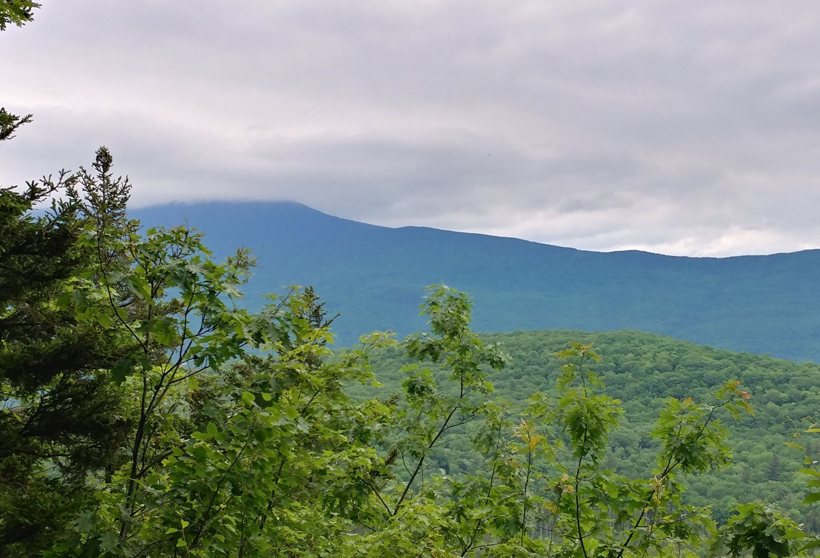
| Mt. Mist overlook |
There was only one overlook. Mt. Moosilauke was shrouded in clouds. I understand that is the normal state of affairs for that mountain.
 |
| Mt. Moosilauke in the clouds |
It was a a quick and uneventful walk down Mt. Mist. It was so nice to be able to stretch my legs and just walk without having to think about the placement of each step. Just a nice woodland trail.
 |
| Amanita |
 |
| Foam Flower. A great native planting for a shade garden. |
The most interesting feature of this section of trail was the ford over Oliverian Brook, near Route 25, and my map had a note not to try and cross it if the water was high. Would the water be high? No idea. The last ford along my trek up from Long Island Sound was through the Westfield River in Westfield, Massachussetts, a much larger river that was in drought conditions as I passed through. This river turned out to be much smaller and no problem at all.
 |
| River Ford |
What made the ford interesting were the massive stone steps on either side, obviously designed not to wash out during a flood. They were also a good spot to sit down and put your boots back on after wading through the water, which didn't even get up to my knees.
 |
| Steps down to the ford |
There was about another mile of trail after that, gradually uphill towards, and suddenly I was at my car at the base of the Mt. Moosilauke on High Street. That was quick. It was only 1:00 or so and I was done hiking.
 |
| Lincoln Tourism |
So I headed back to the B&B, took a shower, and waited for my husband to finish his 18 holes of golf. Normally we finish up about the same time, but this hike was so short I was done early. Eventually I drove up I-93 into Lincoln and checked out the White Mountains Visitor Center. They have a nice diorama of the White Mountains. I also stopped at the
Mountain Wanderer Book Store, which specializes in hiker/outdoor books.
 |
| Diorama of the White Mountains |
In the meantime, my husband finished up his golf game (I hear the bugs were quite bad and he forgot bug spray), and had taken a shower. Great! We took a drive back to Plymouth and had dinner at the Last Chair, where I was able to enjoy another glass of 11th Regiment IPA. Nice!
 |
| Storm Clouds building over the Last Chair restaurant. |


No comments:
Post a Comment