 |
North on blue (snowmobile trail and roads)
and east on purple (rail trail) |
Day two, and I had a couple possible way to deal with the "POSTED" section of the snowmobile trail north of Methodist Hill Road at the beginning of the day's walk. The easiest option was to simply walk down Methodist Hill Road for 2.5 miles. Another possibility was to try to find "Atherton Road", as shown on Google Maps, and which leads to Durkee Road and the snowmobile trail further north. I went for a third option, which was to try and bushwhack around the part that was closed off due to logging. It only looked a few hundred yards wide from the road.
So that's what I did. Bushwhacking can be a lot of fun if the woods aren't too wet or thick and you're not in a hurry. I started at a spot a bit west on Methodist Hill Road that looked like it may have been a road or something there at one point.
 |
| Started bushwhacking here on Methodist Hill Road |
As bushwhacking goes, it was pretty easy. But much longer than expected. I was so close to the gps route for the snowmobile trail, yet the freshly logged area was forever to my right. Eventually I got to the old road that the snowmobile trail uses. Looking back, it was crossed with tubing for collecting maple sap. The tubing went right across the road. So that's it, a new sugar bush. Later, I checked the GIS tax maps and found that the roads I was trying to follow were not town property, so the property owner can shut them down.
 |
| Snowmobile corridor #5 seems to have been replaced by a sugar bush |
I continued a bit further along the old road and came to the end of the logged area about 3/4 mile from Methodist Hill Road. That was a lot farther than I expected. I hope the snowmobile clubs are able to find a new route.
 |
| Logged area along "Durkee Road" (snowmobile trail 5) |
 |
| Durkee Road (Snowmobile trail #5) |
But the trail was beautiful once all the tree work had ended. Very quiet and peaceful.
After a relaxing stroll along Corridor 5, I came to the junction where I was planning on leaving #5 and heading east on a club trail towards I-89 exit #16. The snowmobile gps route I had obtain was a little sketchy heading north, crossing farmland. But at the last minute, I decided to try it anyway, since trail #5 lead straight to the Northern Rail Trail, eliminating all road walking. I turned left per the sign and continued on. After about a third of a mile, I checked my gps and realized I was heading west to Rt 120. Not what I wanted, so I turned around head back up the hill to go back to the original plan. It seems the gps route I purchased wasn't up to date, because the route they gave me showed 5 going north, not west. Possibly the trail turned north a bit further down the trail, but I didn't want to go any further on foot not knowing where the trail was headed.
 |
| Major junction |
The club trail heading down the hill to Exit #16 was a pleasure. Another old woods road, it seems.
 |
| Snowmobile club trail to Exit #16 |
The snowmobile trail was a bit overgrown near the road, but it was just a matter of wading through some goldenrod and such. A gate marks the trail entrance at the bottom of Methodist Hill Road.
 |
| Gate at Methodist Hill Road |
I headed left onto the road and followed it around the curve, with the street name changing to Whaleback Mtn Road, and was crossing over I-89 within a few minutes. There's a gas station and a truck stop there at Exit #16, but I kept walking.
 |
| Crossing I-89 |
Then there was a good long road walk on Eastman Hill Road. It's paved, but there wasn't much traffic. And according to the sign, it's a Scenic Road.
 |
| Eastman Hill Road |
The road goes gradually up the hill, gaining 350' in elevation over the first mile. There are a few homes, but mostly it's woods on either side.
 |
| White Birch and White Wood Aster |
At a clearing near the top, the moisture hanging in the air nearly obscured the distant hills.
 |
| Nothing is certain but change |
Eastman Hill then plunged downhill at an 18% grade (according to the sign), so steeply I had to focus on not slipping on the wet pavement. I don't know how they manage in the winter.
 |
| Eastman Hill Road |
At a hairpin turn, I was on the lookout for an old road going into the woods on the right. This road showed up as a trail on Garmin Basecamp, and had the look of an old town road. I just didn't know if it was posted. It wasn't. Yay!
 |
| Old road |
Going down the old road eliminated the rest of the roadwalk on Eastman Hill Road as well as a nasty roadwalk down Route 4. This was so much better! The entire roadwalk for the day was less than two miles.
 |
| Coming out onto Monica Road |
After walking through the woods for about half a mile, the old road begins to transition to Monica Road, line with homes, then crosses Route 4 at Payne Road just downstream from the dam that forms Mascoma Lake. I rambled over to the dam to check it out.
 |
| Mascoma Lake Dam from Payne Road |
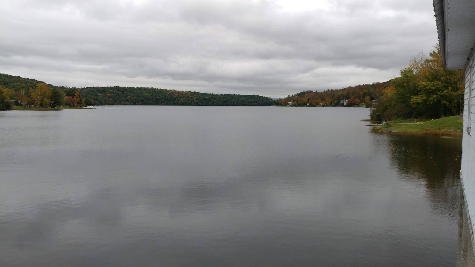
 |
| Mascoma Lake from the dam |
 |
| Mascoma Lake Dam |
The Northern Rail Trail was just a few hundred feet up the road, below a bridge. I wasn't sure if I'd be able to access the trail from up above, but there was a path leading right down to the trail. Great!
 |
| Payne Road bridge over the Northern Rail Trail |
All that was left for the day was 2.5 miles on this super easy path. Piece of cake!
 |
| Northern Rail Trail |
The rail trail followed the north shore of Mascoma Lake and was scenic the entire way. I was happy that the rail trail was not paved. The crushed stone made for much nicer walking.
 |
| Sumac along the rail trail |
There were enough trail users on this Sunday afternoon that it was important to keep to the right and allow others to pass on the left, especially people on bikes.
 |
| These people are everywhere up here |
There were stuffed cute/creepy people everywhere during our trip. I mean everywhere. This seems to be a local fall tradition. There were about half a dozen along the rail trail section I walked. They were out by the streets, in front of churches, everywhere. This is not something we see in our corner of the universe (Connecticut). The stuffed people would emerge from the fog as we were driving around New Hampshire as if out of a Stephen King novel.
 |
| Great views |
After a couple of mile along the shore front, the rail trail went through a very cool rock cut guarded by a hippy cute/creepy person.
 |
| Guarding the rock cut |
The rock rose up on both sides of the trail had lots of old carvings from the late 1800s and early 1900s. Graffiti was a lot harder back in the day.
 |
| Going through the rock cut |
At this point my husband had joined me, coming in from Main Street in Enfield. He had parked a bit further to the east than I planned, so we crossed a big bridge over a river and passed behind a laundromat on Main Street to arrive at the car. Across the street was a restaurant, which would have work except it was about 3:00 pm.
 |
| Very old graffiti |
After a nice hot shower at the Hilton Garden Inn in Hanover, we had dinner at Jesse's Steakhouse. It was crammed with tourists. License plates were from all over the country - California, Florida, New Jersey, Ohio, etc. Not many local, though. That's usually a bad sign, but we went with it and had a great meal.


No comments:
Post a Comment