 |
| Heading up Bare Mountain |
Saturday hiking! I avoid it at all costs. But we were up for the weekend, so I made the best of it and was on the trail by 7:00 am after driving through pea-soup fog in the river valley. My original plan was to start at the top of Mt Holyoke at the Summit House, but at the last moment realized the gates might not be open until 9:00 am. So I instead started at the ample parking on MA 116 for the Notch Visitor Center and did the hike in reverse. There were already half a dozen cars in the lot.
 |
| Art display on top of Bare Mountain |
This section runs along the top of the Holyoke Range from Bare Mountain to Hitchcock Mtn, the Seven Sisters (a part of the ridge with lots of moderate ups and downs) and finally Mt. Holyoke and the Summit House. It's supposed to be one of the most grueling hikes, and it was.
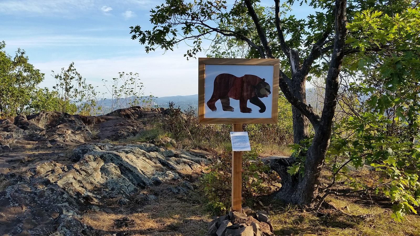
An artwork display at the top of Bare Mountain was most unexpected. The sign below it said it was from the Eric Carle Museum of Picture Book Art. "The Carle is pleased to present
Brown Bear Everywhere. This outdoor exhibition celebrates the 50th anniversary of Eric Carle's first picture book,
Brown Bear, Brown Bear, What Do You See? written by Bill Martin Jr. This reproduction from the story is one of 14 images sited at public locations around Amhearst through October 10."
 |
| Brown Bear, Brown Bear, What Do You See? |
I really enjoyed the display and vote for more trail art like this. Well done! I wasn't familiar with Eric Carle was or the
Brown Bear book, but one of his other books rang a bell:
The Very Hungry Caterpillar.
 |
| View from Bare Mountain |
 |
| Radio (?) Tower on Bare Mountain |
There are lots of towers along the Metacomet Ridge: Cell towers, radio towers, fire towers, beacon towers, and tourist towers. They become landmarks. Sometimes you pass one that's a little different, like the one on Bare Mountain which I've seen referenced as a radio tower.
A pair of conduit pipes go right across the trail, and further on is a metal box with some folk wisdom on it.
 |
| I hope it's not me. |
Section 7 is considered to be one of the most difficult parts of the M-M Trail, with lots of steep ups and downs, so I gave myself plenty of time and brought too much water. According to the NET website, there is 2633 feet uphill and 2311 feet downhill for the section, although I already completed the part between the river and the Summit House. It's not so much the total elevation changes as the steep, hazardous footing, that makes this section a challenge.
It looked to me like most of the steep inclines were really just caused by poor trail design rather than any constraint in the topography. Trails should avoid going straight down a steep slope unless there is no other option, and in this case it looked like there was plenty of opportunity to have the trail angle down the side of the hill, benched in.
 |
| Why does the trail go straight up the hill? |
The design was causing a lot of erosion and some sections were really treacherous. I crept down some the steepest slopes very slowly using my trekking pole for added support and still managed to slip and fall on my butt when the soil shifted under my feet. Part of it was all that water in my pack throwing off my balance (I dumped some of it out later on), but trails should be designed for that. These are not cliff scrambles on rock. They are on loose dirt that rolls and gives way under your feet. It must be especially bad in November after the leaves fall.
 |
| This was the only set of stairs |
I recently worked on rerouting a similarly steep section of a CT Blue-Blazed Trail with guidance from CFPA and was told the goal should be for the trail slope to be 8% or less, and also less than half the hill slope. If the hill has a slope of 8%, then you want a trail slope of no more than 4%. If the slope is 20%, you would try to keep the slope at 8% if possible (or use something like stairs). This is to prevent water from running down the trail and to increase hiker enjoyment of the trail.
 |
| From Mt Hitchcock looking towards Mt Holyoke |
The people who like the super steep slopes are the fitness buffs, and they will object to any modification of the trail route to eliminate the steep sections. They enjoy conquering the challenges and obstacles. Which leads me to the worst part of this trail: It's just a big fitness track. Although I started at 7:00 am, I had to step off the trail over and over and over and over to allow trail runners and power walkers past. I bet I stepped aside 20 or 30 times.

The occasional runner isn't a problem. This was a steady stream. They ran alone, in pairs, or in groups, decked in spandex and often sporting headphones. They focused on their feet, not looking at the woods or the overlooks. Some didn't run, but traveled light in their exercise-wear, carrying nothing except a water bottle and power walking as fast as possible. It was clear they did this often and were just getting it over with so they could move on to the next thing on their to-do list for the day. I did run across a few people actually hiking the trail, and they were also very disappointed with the swarm of fitness buffs. This is not a place for a relaxing nature hike, at least not on a Saturday.
 |
| View from the Seven Sisters |
So I was basically just trying to get the hike over with because of all this fitness activity, rather than actually enjoying ridge. If your goal is to hike and get out in nature, then I would recommend doing this hike on a weekday if possible when the runners are hopefully at work.
 |
Approaching Mt. Holyoke from the last of the Seven Sisters.
Mt Tom is in the background. |
 |
| The trail crosses the park road to the Summitt House at the bottom of Taylor's Notch. |
 |
| Tiny feather |
Nearing the Summit House, I spotted a tiny feather that looked like a miniaturized major hawk feather. I kept it as a souvenir to symbolize the slow savoring of a scenic trail and the little things the runners miss.
 |
| The Summit House picnic area |
 |
| The plane crash memorial |
 |
| Back to the Summit House |
Since it was now Saturday, the Summit House was open. The first building here was constructed in 1821, and replaced with a larger structure in 1851. This was a hotel, and visitors could ride a steamship up the Connecticut River to a convenient train that carried them up the mountain to the hotel. What a difference a few decades makes.
 |
| Inside the Summit House |
The most interesting thing in the building was the fire extinguisher, which was enormous. A metal plate on the fire extinguisher identified the product at "SODACID Fyr-Fyter" with direction to "WHEEL TO FIRE - OPEN VALVE ON CAP -- LOWER HANDLE TO GROUND." I wonder if they ever had to use it. There was one on each floor.
 |
| Fire Extinguisher |
For the second time in two days, my husband picked me up at the Summit House, this time after an 18-hole round of golf. We headed back to the Notch Visitor Center to pick up my car, and ventured into the little nature center for a look.
 |
| "The owls. Are not. What they appear." - a line from Twin Peaks. |
Everybody loves a diorama, including a miniature Holyoke Range under glass. I tried to identify the seven peaks of the Seven Sisters. I still can't do it. Afterwords, we headed back to the hotel for showers and a rest, then headed out for some dinner and shopping in Northampton, followed by the movie
The Revenant on HBO. The next day we left, but not before spending half a day at the Big E. All in all, a great weekend.
 |
| Holyoke Range diorama |


No comments:
Post a Comment