I'm back to the NET after being away for several weeks. I needed to finish up hiking the Tunxis Trail, which I started last fall and promptly broke my ankle the first day out. It was quite a contrast to the NET. Different kind of terrain and it was very isolated and wild (read blog post here). Also had some vegetables to get in the ground and there was a trip to the Cape.
Probably the hardest part about letterboxing at Timberlin was the radically altered trail system. There are new trails as well as trails that used to be one color and are now another color. And apparently no map online that showed the entire trail system so I could plan my route out ahead of time. So I followed my native guide (Teeker), who helped me navigate this uncharted territory. My gift to you is the above map, such that it is, based on my gps tracks (the southern part of the green trail may be a bit off as it diverged -- see this map). The trails are all pretty easy except for a short mossy scramble down the north face of Short Mountain. That section wasn't horrible, but it was enough that I left my backpack behind knowing I would be right back. (Later I was confused as to why my gps didn't show a track for my descent...it was sitting in my stationary backpack back up on the hill duh.) I did read about plans to extend the red/blue trail up to short mountain, so my map may be soon obsolete.
 |
| Pond at Timberlin Park |
The Timberlin Golf Course is a major feature of this park, which might explain the algae in that pond (golf courses use a lot of fertilizer). You drive through the golf course to get to the main parking lot, and I found six golf balls while boxing.
 |
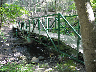
| Boy Scout bridge built by Sean Haber, Troop 24 |
 |
| Red Berried Elder |
The other option is to take the blue & white trail from the pavilion area, and head up the south side. You're looping around Short Mountain clockwise. I was headed up from that direction when I passed these red berries on a bush that looked sort of elderberry-ish. These are Red Berried Elder, and are not edible like normal Elderberry.
 |
| View of West Peak near the South Overlook |
There are several overlooks, a couple of which are completely unobstructed, and others areas with partial views.
 |
| Pasture Rose |
Several of the overlooks had these stunted rose bushes on them. I believe they are Pasture Roses, a native rose known for its short stature and ability to grow in dry, rocky areas. The flower looks like the roses you see at the beach, Rugosa Rose, but the bushes are very small.
 |
| Looking northwest towards a vineyard |
The day I descended the north side of Short Mountain, I forgot to replace my camera's memory card, and had to switch to the cell phone camera for the last two pictures. Sorry.
 |
| The descent down the north face of Short Mountain |
The descent is not long, but it is steep and the damp, mossy terrain made for some slick areas. It was a scramble, and I used my hands on occasion. But I had the feeling that if I fell, I might break a couple legs but would survive, so I had that going for me.
 |
| Interesting Trail Sign |

No comments:
Post a Comment