It wasn't a bad walk along the road. We passed a cat guarding some chickens.
This section of trail has been completely rerouted since the latest version of the CT Walk Book came out, so there are updates online here. Unfortunately, I didn't see the first link, only the second, which is hard to read, so I overshot the trailhead and walked almost to I-91. Then I discovered the trail doesn't go into the woods from the road, but turns onto Bell Street and follows that for some distance. Sigh.
So it was a good hour before I really got hiking, but it started out nicely at Highland Pond. I was looking for the orange trail for a side trip but couldn't find it. Turns out it was just 100 feet from the NET trailhead off of Bell Street.
Lots of beaver sign here and waterfowl, and you can see the quarry in the background.
That bridge is a little nicer than I'm used to on the NET. Before long, the trail came out on Atkins at a cemetery, and there was another road walk before the trail headed into thick secluded forest. Finally!
The trail is pretty easy, gradually heading up a hill, then down into a gully. Hope there's no bear in that cave.
CFPA has some "Flat Stanley" letterboxes along the trails, like this one here, which uses a pink eraser for the carving material.
Eventually the trail passes an unexpected canal and then climbs quickly up Chauncey Peak for some gorgeous views of Crescent Lake. Although it was a beautiful Sunday, I saw only one hiker until just before reaching Chauncey, and then there were plenty of people.
Castle Craig is just visible on Meriden's Hanging Hills (Hubbard Park).
A view north towards Lamentation Mountain, the next leg of the journey.
The views up here are just about the best I've had so far. Looking north, one can see Hartford.
To the south is a hint of New Haven and Sleeping Giant.
And then to the east the land opens up at the quarry. There are some teenagers there throwing rocks, so tiny they look like ants. The quarry has been operated since 1898 by the same company that also was mining the head of the Sleeping Giant before public outcry, the Great Depression, and legal maneuvers halted that process. Here's a blurb on the history.
Continuing south along the ridge, there's the a view of Beseck Mountain, overlooking Black Pond...
...and the twin peaks of Mount Higby (with Beseck continuing on to the right).
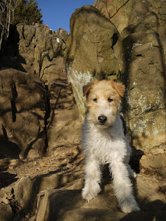
And then the friendly blue blazes played a joke on me and disappeared over the edge of the cliff. My first thought was, "that can't be right," and just then I heard a group of hikers coming up from below. I edged closer to the cliff, and watched as they scampered up the rock. It's easier to go up than down a rock scramble, though, so I had to make a decision. Every hiker should know his or her limitations and have the sense to turn around when necessary. I determined the wise thing to do would be to turn around and descend the north slope, the way I came up. Not being very wise, I rolled my back pack down the cliff, unleashed the dog, and very slowly slid down the rock on my butt, maybe 25 or 30 feet. Having survived the rock scramble, I still had to pick my way down the steep slope very carefully using my trekking poles, because the ground was eroded and full of loose dirt and gravel.
The parking area at Cresent Lake was right at the bottom of the hill. Another successful hike along the NET!


No comments:
Post a Comment