Monday, August 19, 2019

NH Appalachian Trail: Mt. Liberty


A.T. access starts on the White House Trail from the Liberty Spring parking area.
Time to climb up and along the Franconia Range! This was easily the most challenging hike so far, and it needed to be backpacked. My goal was to start at Franconia Notch off of I-93 where I left off last time, climb up to the ridge and cross the peaks of Mt. Lincoln, Lafayette, Garfield, South Twin, Guyot, and Zealand, all 4,000-footers, before descending the ridge down to Zealand Trail, where I would leave the A.T. and head towards the Cohos Trail.  I allowed four days, which included the long drive up from Connecticut.

Hobblebush
I decided I had to start on a weekday in order to get a parking space at the Liberty Spring parking lot, so when I arrive at 11:30 am on a Monday morning, there were no problems parking. This is apparently a very popular spot for thru hikers to take a break from the trail. They grab a shuttle into Lincoln and spend the next day (a "zero day") doing laundry and restocking their packs. They then arrive back a day later, clean and refreshed. But I didn't see any thru hikers on my first day. They undoubtedly had an earlier start and were long gone before I parked my car.
Franconia Notch Bike Path
There was a surprising lack of signs telling you which way to the A.T. considering that most thru-hikers appear to be using this parking area to grab a ride. The trail map in my pocket showed the short access trails, but not the names of the trails. So I didn't realize that the access trail I needed was called "White House Trail," until after I got home and started looking at my photos. But there were    arrows pointing towards Liberty Spring Trail, and my map did have that labeled as part of the A.T., so was able to follow the arrows. Along the A.T. in the Whites, there are a number of locations with great trail signs that do not mention the Appalachian Trail. You're supposed to know the local name of the trail and go with that. In reality, local trail names are just another thing to juggle and keep track of when you're trying to make time, so a number of these signs have had "A.T." added after the fact, sometimes scratched into the wood, sometimes with paint, and other times with a Sharpie.

The Whitehouse Trail joined the Franconia Notch Bike Path for a very short ways, then crossed the Pemigewasset River where I left off last time (this is now also the A.T.), and then took a right onto Liberty Spring Trail and started up the mountain.

The big loop everyone was doing
It was very hot and steamy. The forecast was for potentially record-breaking heat, and my glasses spontaneously fogged up for no reason. I prayed that it would cool down as I climbed the mountain, and started up slowly.

Passing the junction with the Flume Side Trail, I didn't realize that this is a very popular two-day backpacking loop, and that most of the people I would see that day would be doing the loop. They go up the Flume Slide Trail, scale Mt. Flume and then Mt. Liberty, and spend the night at Liberty Spring Camp before descending down the Liberty Spring Trail the next day. Mostly it appeared to be college kids getting one last adventure in before school started. 

Wonderful water on a very hot day
After climbing about 700 feet, which felt like more due to the heat, the trail crossed a nice clear brook, a great spot to take a break and cool down. A few bright red maple leaves decorated the brook. Let it be fall!


Hot and sultry but with a hint of fall
It did get a bit cooler and less oppressive above the stream (elevation 2100), but not by much. Every so often there was a wisp of a breeze. The uphill was technically very easy. No decisions to make, no scrambles, just a steady boulder to boulder climb that went on and on in the heat.

Up, up, up, up.....
It steepened after that, going up another 1700 feet. There weren't many hikers on the way up.

Finally
I took it very slow. There was no rush, since I needed to camp at Liberty Spring and wait until the next morning to really start hiking. The next tenting site after Liberty Spring was on the far side of Mt. Lafayette, another seven miles, and it would be reckless for me to try to make it when I didn't even start hiking until 11:30.  So it was nearly 3:00 pm before I arrived at Liberty Spring.


Singles only get half a platform.
This was the first camp I'd stayed at with an attendant and wooden platforms. I paid the attendant $10 and he told me the rules, then let me go find a platform. If you're in a single tent, you only get half of the platform in case someone else rolls in and needs the spot. I was lucky. No one took the other half of the platform.

Creative staking
My tent is only partially free-standing, so it was a challenge to set up on the wooden platform. I used a variety of techniques to stake the tent, and had to cut some extra pieces of string here and there.

More creative staking
After getting the tent set up, I wandered over to the spring. It was most adorable spring I've ever seen. It trickled down a piece of notched wood lined with carefully overlapping leaves. There was often a line at the spring because it flowed so slowly and everyone was so hot and thirsty.

I only saw one spring. I mention this because the name of the camp and the trail is sometimes plural and sometimes not. The camp diagram had the plural form, while the trail signs had it singular. Officially, I'm pretty sure it's the singular Liberty Spring. But it's often called the plural "Liberty Springs," which I think is just some tick people have with wanting to add an "s" at the end.  This seems to happen a lot with place names for some reason.

Liberty Spring.
After filling up and filtering plenty of water for the next day, I grabbed the sandwich I brought up and headed up the trail to the top of the ridge, then took a right towards Mt. Liberty. It's a short spur off of the Appalachian Trail.
On the ridge heading towards the Mt. Liberty summit
It was a delight to walk along the ridge line sans the heavy pack, and it was cooling down as well. It didn't take long to get to the top of Mt. Liberty. This is the peak with the perfect pyramid shape when seen from below. The views were breath-taking, and there were only a few passing hikers heading in the opposite direction, towards Liberty Spring Camp. So I mostly had the place to myself. I sat down and ate my sandwich and enjoyed the view.

Looking south-ish down the notch and I-93
From the top you could vaguely see I-93 far below as it ran through Franconia Notch. Across the notch were North and South Kinsman and Mt. Moosilauke beyond them.

North and South Kinsman to the west, the previous hike
The view to the north consists of the ridge and peaks I'd be hiking over the next few days. The route would follow the ridgeline in a semi-circle above the Pemi Wilderness. To the left was the ridgeline with Mt. Lincoln and Lafayette, then Mt. Garfield stood solo to the right, and finally the long ridge heading east with North Twin, Guyot, and Zealand. Wow. Below them all was the Pemigewesett Wilderness.

Looking north towards Lincoln/Lafayette, Garfield (center),
 and the A.T. ridgeline beyond (South Twin - Zealand)
Back at camp, I grabbed some more water and explored the site. It's oriented along a pretty steep hill, and the platforms were necessary to created level sites. There were a number of larger shared tents. Most of the campers were college-aged and enjoying their dinners. I saw piles of pots and pans. These were not your typical backpackers. They were kids having an adventure and making do with whatever materials they could get their hands on.

Pee in the woods
Although the sites were spread out well, and I had chosen one on the far end, some of my neighbors were pretty loud. Groups of boys. It really wasn't a problem until it got dark and I went in my tent and tried to read a book. It was impossible to concentrate. I put on my ear plugs and sleep phone (they play white noise), but even then I still heard boisterous laughing cutting through the night. It was annoying. I wish the caretaker would have said something to them. But eventually they quieted down, around 10:00 pm and I was able to go to sleep.

Platforms were well-spaced

Monday, August 12, 2019

NH Appalachian Trail: Kinsman Mountain


The Kinsman section of the A.T.
Amanita sp.
After a month of Connecticut heat and humidity, work, and random issues like a root canal and chopping the tip of my finger off, I was finally able to get back on the trail, this time with my friend Sarah.  This was supposed to be the relatively easy section sandwiched between Moosilauke and Franconia Ridge, but it turned out to be pretty epic, in large part due to a lot of driving each day.

I left southern Connecticut at 6:00 am on Sunday morning for a 10:30 am rendezvous in Franconia Notch at the Liberty Spring parking area. This is an extremely popular hiking area, and the big hiker parking lot was packed completely full, with cars parked up on the grassy shoulders. Not a space anywhere. I hadn't considered this possibility (although it seems pretty obvious now). For most of my hiking up from Long Island Sound I've been parking in tiny pull-offs at little-known trailheads, The White Mountains are radically different and far more popular, though, and it appears everyone beat us to the lot. But I drive a tiny car, and after taking a second look, I managed to wedge myself in between cars, only partly on the pavement.  Nice.  

The Clintonia had formed berries ("Blue Bead Lily")
My friend pulled in shortly after that and we drove over to the Beaver Brook parking lot at the base of Mt. Moosilauke. There's a fee for parking in the lot, $5 per day, which is fair. That lot was also full, but there were a few spots on the grass still open. 

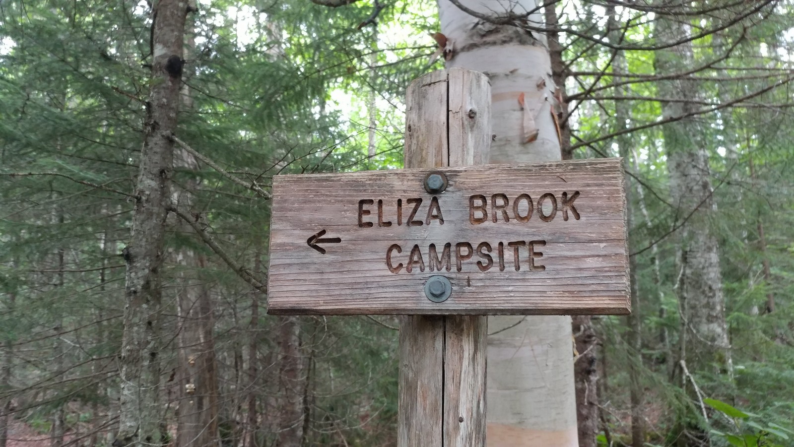
It was 11:15 am when we finally hoisted the packs onto our back and hit the trail. Phew.  Our goal was the Eliza Brook campsite, seven miles in. Seemed easy enough and we had plenty of time. The hike profile didn't look too difficult on paper. But it had been about six weeks since I carried a pack, a month since I'd been up in the White Mountains, and two weeks since I'd done any hiking at all (raging plantar fasciitis again, addressed with a cortizone shot to the heel).  It's amazing how quickly you fall out of shape. 


Finally on the trail!
The trail started uphill quickly from Route 112 and Kinsman Notch along some fine rock steps but eventually moderated into a series of ups and downs and false summits on our way to the top of Mount Wolf (elev. 3478).


Another wet trail in New Hampshire
It was a joy to be rambling down the trail in the north woods again, this time with a companion. The Clintonia (Blue Bead Lily) that had been blooming and covered with Canadian Swallowtails on Moosilauke a month ago was now in full "blue bead" mode with large berries. How quickly the seasons pass. Happy I was able to partake in the trail earlier in the season, even with the bugs.
Looking east towards Franconia Ridge from Mt. Wolf
Mt. Wolf became something of a running joke because we kept thinking we were there and we weren't.  But eventually we encountered another rise, this one marked with a sign pointing to an east-facing overlook. Franconia Ridge was getting closer.
Steeplebush Spirea under the powerlines
The ridge were were ascending is part of Kinsman Range, also called the Cannon-Kinsman Range, which runs between Kinsman Notch (where we started) and Franconia Notch. Mt. Wolf was the first and lowest of the peaks along this range. The range includes three "4,000 Footers": Kinsman South Peak (4358), Kinsman North Peak (4,293), and Cannon Mountain (4,080). We would be climbing all but Cannon Mountain on this trip.


View towards Lincoln and Woodstock from a powerline crossing
We weren't in any particular hurry, but kept a solid pace which turned out to be about one mile per hour.  So while it wasn't the most difficult section of trail, the footing was tricky enough to slow us down. The total elevation gain was about 2450 feet, with 930 feet of descent. Hikers were few and far between. I don't think we saw any day hikers. Only a few backpackers, and one or two people thru hiking the AT in reverse (southbound).

Eliza Brook Camp
The Eliza Brook campsite turned out to be a very nice one. It was a Sunday night, so the weekend warriors had abandoned the trail and there was only one other group there besides us. The hardened sites (no wood platforms yet!) were set above scenic Eliza Brook, which babbled nicely in the background. And there was nice spacing between the sites.


First bear box since Long Island Sound 
There was even a bear box (yay!). I believe this is the first one I've seen since I started this journey on the NET in Connecticut. So much easier than wandering around trying to find the right tree to hang a bag.

No bugs!
Best of all -- no bugs! None. I was able to lay down in my tent at dusk with my head sticking out just staring at the tree tops and wondering what that bird was that kept calling. Wood thrush?

The next morning we managed to get underway by around 7:00 am with the goal of getting to my car in Franconia Notch AND driving back home to Connecticut. It was eight miles to Franconia Notch and another half mile up an access trail to the parking area. That sounds reasonable, doesn't it? If we took too long, we could always find accommodations for the night, our Plan "B."

A bog!  Harrington Pond
Pitcher Plant and Sundew
The trail followed Eliza Brook up a ravine for almost a mile, with one waterfall after another. It was gorgeous. And then it climbed out of the dark ravine and before us was a sunny bog chock full of carnivorous plants. Another first for the NET-Cohos route. I bet there will be more in moose country. It was tricky getting through the mud in this section. Bog bridge planking was hidden an inch or two under the mud and water in places. Exploration with the trekking poles helped.

Getting up Kinsman's South Peak was tough
So that was slow-going, but the next hour and a half would kick our butts as we scrambled up the side of Kinsmen's South Peak. One scramble after another after another. You had to stop and ponder whether to go to the left or the right. Over and over until we were exhausted, physically and mentally. The views were great on the way up, though, so we were able to stop and enjoy them while gasping for breath.

Brunch on South Peak, Moosilauke in the distance
We were so happy to reach the top of South Peak, not the very top, but close enough, where it flattened out and opened up and proved to be a great spot to stop for a quick brunch while gazing out at Mt. Moosilauke in the distance. 

Mountain Cranberry on South Peak
The next part was a lot of fun as we walked through the krumholz near the treeline with views in many directions on our way to the Kinsman North Peak.

Hiking through the Kinsman Krumholz
It was here that we started seeing a lot of day hikers. A flood of them. Apparently they come up from Lonesome Lake, where many trails converge, and head on up to bag their 4,000 footers.


View east from the North Peak: Cannon Mtn to the left,
Lonesome Pond center, Franconia Ridge on the horizon. 
It was very steep going down to Lonesome Lake, but because it's so popular, the trail had been improved over the years with a variety of steps. It reminded me of Beaver Brook Trail, the one I went up instead of down.


Wood block steps bolted into bedrock
There were plenty of wood block steps that had been attached to the bedrock with rebar. There were toe-holds drilled into the rock. And of course there were plenty of impressive rock steps. It was wet and slick in some areas because that seems to be the way of New Hampshire, so that really slowed us down. Most areas didn't have the steps and you had to stop and make a decision about which way to get down. Sometimes it was a butt slide that made the most sense. Sometimes we would stand there and discuss it like we were a committee of two.  In the back of our minds the clock was ticking and we really did want to get home that day.
Toe holds drilled into steep bedrock
With the toe steps drilled in steep rock we pondered whether to go down backwards, just butt slide it, or be bold and use them as steps. I think all methods were used. Not sure which one was best.

Artistic wood block steps
A couple of the wood block steps were in disrepair and I could finally see how they were attached: two vertical iron pins drilled into the rock. Curiosity satisfied.

Lonesome Lake Hut
It was about 2:30 pm when we rolled into Lonesome Lake Hut. I had once thought of trying out the hut experience just to say I did it, and I thought it might be $40 or something, but they charge about $130 a night and require reservations. For that you get a meal, a bunk in a bunk room with a bunch of strangers, and use of the composting toilets in another building. I'll stick with my tent. But it's fun walking into the hut, filling up your water containers at the sink, and they usually have some snack food you can buy, like brownies.

Lonesome Lake, ironically named
After a good stop at Lonesome Lake (which had a dock of sorts and maybe a dozen people hanging out at the water's edge enjoying the sun and water), we decided it was time to get back to the car. It was almost 3:00 pm. Could we make it back home or would we need a motel? We had about three miles left to hike. It had taken us eight hours to hike 5.4 miles and that was going about as fast as we could go. We needed to go faster. We did. The trail grade eased up considerably, and though we were often still walking boulder to boulder or over uneven roots, we made good time.

I-93 crossing at the Pemigawasset River
I was never so happy to hear the sound of a highway as we approached I-93, which runs through Franconia Notch. The Appalachian Trail crosses under the highway along the shoreline of the Pemigawasset River. Just a bit further and we encounter a paved bike path that leads to the Flume. That was our turnoff. We took it a short ways and then saw a hiking trail go off to the right. The sign there just said something vague like "Trail to Parking." Which parking? The State of New Hampshire does not communicate very well. Just a couple more words on that sign could convey so much important information.  Their exit signs on I-93 just say "exit" with no additional info. Exit to what?? I had to stop and look it up on my Guthook App because we did not have time to take a wrong turn. Yup, that was it. The trail to Liberty Springs parking.

The total ascent for the day was about 3,000 feet and the descent was about 3600 feet.

We made it back to the car (and nearly empty parking lot - Mondays are apparently a much easier day to park) at around 4:30 pm. Phew. We still needed to go back and get the other car at the base of Mt. Moosilauke and drive home to Connecticut. We could do it! And did. It was a long drive back, but I got home around 9:30 pm and was able to sleep in my own bed for the night. Success! The hike was more rushed than I liked, but we did it. Next up: Franconia Ridge and the highest point of the NET-Cohos route. 

Sunday, July 14, 2019

NH Appalachian Trail: Mt. Moosilauke

Pretend there is a moose in this photo
All the stars aligned for our hike up Moosilauke. My daughter had wanted to join me for this hike after seeing some photos of the trail (she also wants to take up rock climbing), but her summer schedule left just one day available to do so: Monday, July 8. And what might the weather be that one day? Spectacular!! Unbelievable.

Rough steps drilled out of the rock
I hiked up Moosilauke in August 2000 and, according to my notes, it was covered in thick, blowing fog at the top and was "FREEZING COLD!!" We had brought sweatshirts and jackets and still needed to huddle in the rock shelter at the summit. A man at the top said he had hiked Moosilauke twelve times and only got a good view for one of those hikes. So I was fully expecting my Moosilauke experience to be cold and damp. But no! On the single day of the year we are able to climb this mountain together, the weather is absolutely perfect.


Beaver Brook is gorgeous
I decided to do this section southbound due to the many warnings about descending the Beaver Brook Trail, which is what thru hikers of the Appalachian Trail have to do while loaded down with a full pack. Bless them. This is listed as one of the "Terrifying 25" trails of New Hampshire. Over the winter I had pulled up some hiker blogs like this one and found myself  rather alarmed by photos looking down a series of wooden blocks bolted into shear, wet rock.  Check out that blog for a true sense of how steep it is. And it's always steeper than it looks in photos.
Wood steps drilled into shear rock
So we spotted a car on High Street at the western end of the mountain on our way up the night before, and began our hike on Route 112.  It seemed the most sane way to do it. (My previous hike up the mountain was via the Benton Trail, an easier route).  We got a very early start the next morning and wouldn't you know, most of the trail was bone dry. It still would have been a tense downhill, but nowhere near as difficult as going down if everything was slick.  Going uphill on the dry trail was a good workout, but I personally didn't find any part of it more technically challenging or scary than some of the CFPA trails in Connecticut.

Beaver Brook with Franconia Range in the distance.
I cannot say enough about how beautiful Beaver Brook Trail was. The first mile or so, you're climbing up very steeply alongside Beaver Brook, which is plunging down the mountain. It's cascade after cascade. The trail improvements are worthy of someplace like Acadia National Park. There are many types of steps: wooden steps drilled into rock, big rocks arranged into steps, and steps drilled out of shear rock. All of them are amazing work. Blossoms of Bunchberry and Clintonia lined the trail. It's like that all the way to Beaver Brook Shelter, 1.3 mile from the parking area, where the steep part ends and climb becomes more moderate.

At this point, the trail has climbed about 2000 feet. Let's put that into perspective for northbound NET-Cohos hikers: A hike up West Peak or Talcott Mountain in Connecticut or Mt. Tom in Massachusetts involve a gain of only about 400-500 feet, which is one reason why the New England Trail is so wonderfully accessible. Most people, even if they are out of shape, would be able to climb these ridges. Mt. Grace in Massachusetts was a good 1000-foot climb, and Mt. Monadnock was a solid 1800-foot gain. We've just gained more elevation than if we had climbed to the top of Mt. Monadnock, all in just 1.3 mile. And we've really just started this eight-mile hike.

Tree Dieback
We had about another 1,000 feet up to go, but it would take two miles to do it at an easier grade. Some parts were pretty easy and we could stretch our legs, but many other parts were a tedious boulder-to-boulder affair.

We noticed a few patches of dead trees, although many young trees were coming in. Later on we could see broad patches of dead trees across the surrounding mountains as well. These might be "fir-waves,"  linear patches of dead balsams that are oriented perpendicular to the prevailing wind. The die-back progresses in waves as the trees succumb to old age (living for about 70 years) and the relentless wind.

View from Mt. Blue
Mt. Blue is a lesser peak on the way to Moosilauke and it was a great place to stop for a short break. Black flies hit us for the first time here. It was about 50° when we started our hike, but the sun was warm, and that woke up the bugs. Some of these blackflies were the Mutant White Mountain Black Flies. One was burying it's head in my leg. These aren't the normal tiny gnats that dive bomb your eyes and fly up your nose. These giant black flies simply land and bite. I don't know if they are a different species or some mutant variety they grow in the White Mountains.  The last time I've seen them was in mid-June 2001, when my son and I climbed Mt. Jefferson on a freakishly hot day and were attacked for the entire miserable hike (there was not a wisp of wind at the top), no matter how much 99% DEET I covered myself in. That night I was covered with overlapping itchy welts that lasted a week. There were only a few this time. We covered ourselves with Picaridin and were fine for the rest of the hike.

Rosey Twisted Stalk
Most of the hike was through lovely "High Elevation Balsam Fir Forest," which occurs above 3500 feet. Most of the trees are balsam, and there isn't much plant diversity at these elevations. It being early July, we saw a lot of Mountain Wood Sorrel, Canada Mayflower, Blue Bead Clintonia, and Starflower in bloom. The unexpected find was some Rosey Twisted Stalk, which looked a lot like a red Solomon Seal.
Alpine Zone
The alpine zone was spectacular. Flowers were blooming and the views were gorgeous in all directions. It was maybe 70° with a light breeze. Perfect.

Three-Toothed Cinquefoil (top) and Mountain Sandwort
I enjoyed seeing the Three Toothed Cinquefoil in bloom.  I first came across this plant on the M-M Trail on Gap Mountain and Mt. Monadnock, where it grew in rock crevices at the top.  It was autumn and not blooming at the time, and it took me awhile to figure out what the plant was. I next saw it at Holt's Ledge and Smarts Mountain, and now on Moosilauke, always growing in the cracks between rocks in full sun. Nice to see the flowers.

Unidentified heaths
What a different world it was up here.  Most of the plants were foreign to me.


What a sky
We had started out by 6:30 am, and until hitting the alpine zone had encountered only one other hiker, which was a surprise.  By 11:00 am, though, there were hikers converging at the top from all directions. Mostly day hikers, from the looks of it, but a few backpackers as well. It actually seemed a bit crowded.

Moosilauke summit
I had to laugh at the little square of rock wall near the summit that serves as a shelter from the wind. It's where my son and I had huddled back in mid-August 2000 to escape the cold, blowing fog. No need for that today.

The shelter I took refuge in last time
Looking more closely, there was a tiny but dense patch of flowers growing in the shelter, seemingly from bare rock. Mountain Sandwort is said to thrive where hikers tread, and even benefits to some extent. It grows on ledges and bare summits, and is also found in Greenland.


Mountain Sandwort growing in the shelter
After hanging out for half an hour or so, we continued west on the Appalachian Trail, now following the Glencliff Trail. There was a nice long section that descended slowly through the alpine zone, where the summits of Mt. Cube and Smarts Mountain where visible straight ahead.

Smarts Mtn and Mount Cube in the distance
Several times along the hike I had stopped to exclaim, "This is the most Bunchberry I've ever seen blooming in one place!" and then would take a bunch of pictures. It became a running joke, because we kept finding locations further up the trail that would have even more Bunchberry.  Finally there was an open meadow filled with blooming Bunchberry in the Krummholz. Gorgeous.

Bunchberry blooms in the Krummholz zone

Back in the trees, the iconic swallowtails were all over the Blue Bead Lily (Clintonia) up and down the trail.  I knew them as Eastern Tiger Swallowtails, but it turns out they've been reclassified as a separate species per DNA testing, and are now called Canadian Tiger Swallowtails.

Canadian Tiger Swallowtail on Clintoni

I didn't spend much time looking at the rock during our hike since most of it is covered in lichen. The rock on Moosilauke is very similar to the rock that makes up Mt. Monadnock. Both consist of very resistant rock from the Littleton Formation, especially the Littleton Schist with Sillimanite. At Mt. Monadnock I had taken photos of the Sillimanite crystals, a mineral that was first discovered at Mt. Monadnock. And here they were again on a boulder in the trail. Same thing, different mountain. There were other similarities, I thought, between the two mountains. Both stand off by themselves (the definition of a monadnock). There are dozens of 4,000-footers in the White Mountains, but Moosilauke, at elevation 4802, stands off by itself. It's not part of a ridge and it's not surrounded by mountains of equal height.


Sillimanite crystals in Littleton Schist

At any rate, the hike down the mountain became more of a slog as we started thinking about the things we'd like to do after we finished the hike. We only had this one day before we had to head back. So we tried to pick up the pace, but after passing through the krummholz, the trail steepened into a boulder-to-boulder affair. It wasn't as steep as the Beaver Brook Trail, but it was still tedious and slow. I had packed two rubber-tipped trekking poles and was glad to have them on the way down. My right knee started to act up, and then my daughter asked for one of the poles because her right knee was also causing trouble. The White Mountains are brutal on knees. Eventually the trail did start to angle down the mountain a bit instead of going straight down and the grade became progressively easier as we decended, but it seemed like a long downhill (3.8 miles, 3300-foot decent).  Mostly we talked about Game of Thrones.

We were down at the car by about 2:15 p.m., hot and tired. It was a good long drive back to the first car, but then we stopped for ice cream sandwiches at a camp store on Rt 212, and were back at the Mt Liberty Motel on Rt 3 by 3:30 pm for a swim in the pool. Wonderful! After that we had time for a game of mini-golf in Lincoln, a delicious dinner at the Public House in Woodstock on Rt 3, and then did some gift shopping in Woodstock before head back to the motel to play in the river behind the rooms. What a day!

Mini-golf!